Global Volcanism Program | Image GVP-11927
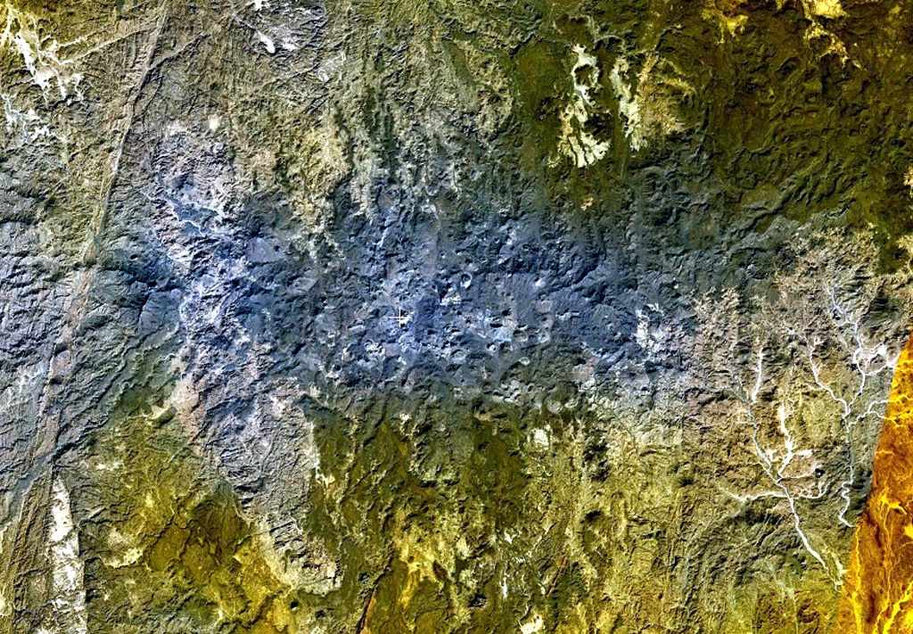
The bluish-gray area at the center of this NASA Landsat image and areas at the upper right are part of the massive Atakor volcanic field. These volcanics cover an area of 2,150 km2 and includes lava domes and abundant basaltic scoria cones and lava flows. Historical pottery has been found within lava flows in the Tahifet area, and oral traditions of the Tuareg people also suggest that eruptions were witnessed. The prominent lineament at the far left is the Inter-terrane Pan-African shear zone.
NASA Landsat 7 image (worldwind.arc.nasa.gov)
![]() This image is made available as a Public Domain Work, but proper attribution is appreciated.
This image is made available as a Public Domain Work, but proper attribution is appreciated.
Galleries: Volcanic Fields
Keywords: remote sensing | volcanic field
Atakor Volcanic Field