Global Volcanism Program | Image GVP-12043
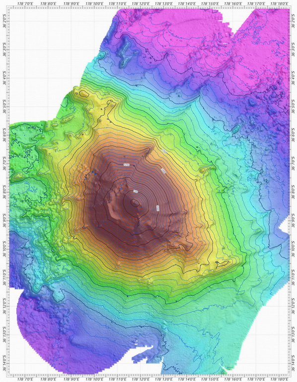
A bathymetric map view shows Rumble V submarine volcano at the southern end of the South Kermadec volcano group. A large plume of gas bubbles was acoustically detected rising from the summit in 1992. Rumble V, the southernmost of a group of seamounts on the southern Kermadec Ridge known as the Rumbles, rises more than 2,000 m to about 400 m below the sea surface.
Courtesy of Ian Wright (National Institute of Water and Atmospheric Research (NIWA), Wellington, New Zealand).
![]() This image is made available under the Creative Commons BY-NC-ND 4.0 license terms.
This image is made available under the Creative Commons BY-NC-ND 4.0 license terms.
Keywords: submarine volcano | stratovolcano | remote sensing | technology | DEM | map | bathymetry
Rumble V