Image GVP-12160
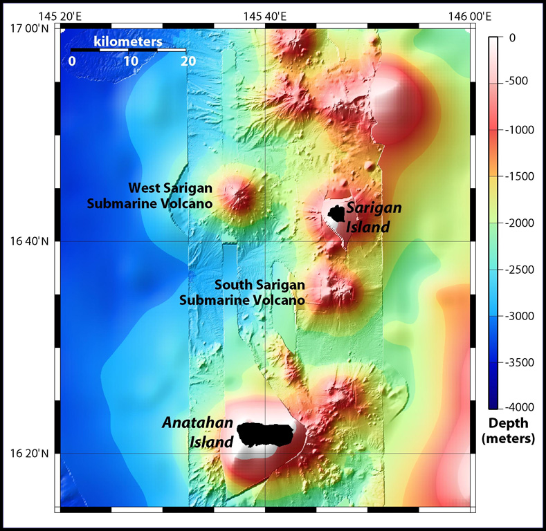
Sidescan sonar imagery taken in 2003 shows South Sarigan seamount rising to within about 184 m of the ocean surface 12 km S of Sarigan Island. It was the site of an explosive submarine eruption in May 2010 that sent a plume of ash and steam to 12 km altitude. The seamount has an irregular summit with multiple peaks, including a possibly young cone at about 350 m depth, and flank morphology suggests it is frequently active.
Map courtesy Bill Embley and William Chadwick (NOAA: http://oceanexplorer.noaa.gov/explorations/03fire/logs/feb17/feb17.html)
![]() This image is made available under the Creative Commons BY-NC 4.0 license terms.
This image is made available under the Creative Commons BY-NC 4.0 license terms.
South Sarigan Seamount