Image GVP-12248
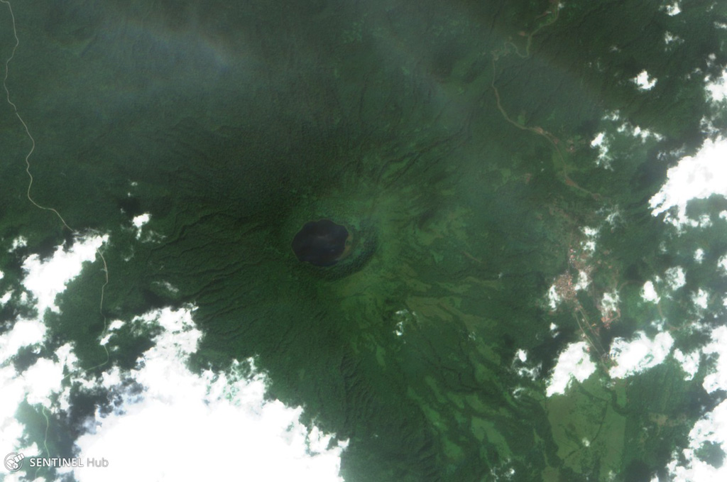
Lago Biao fills the San Joaquin (also called Pico Biao) caldera, seen in this 26 December 2017 Sentinel-2 satellite image (N at the top). The caldera is approximately 1.5 km wide and is covered in dense forest. It is W of San Carlos, in the SE of Bioko Island in Equatorial Guinea.
Satellite image courtesy of Copernicus Sentinel Data, 2017.
![]() This image is made available under the Creative Commons BY-SA 4.0 license terms.
This image is made available under the Creative Commons BY-SA 4.0 license terms.
Keywords: caldera
Pico Biaó