Image GVP-12345
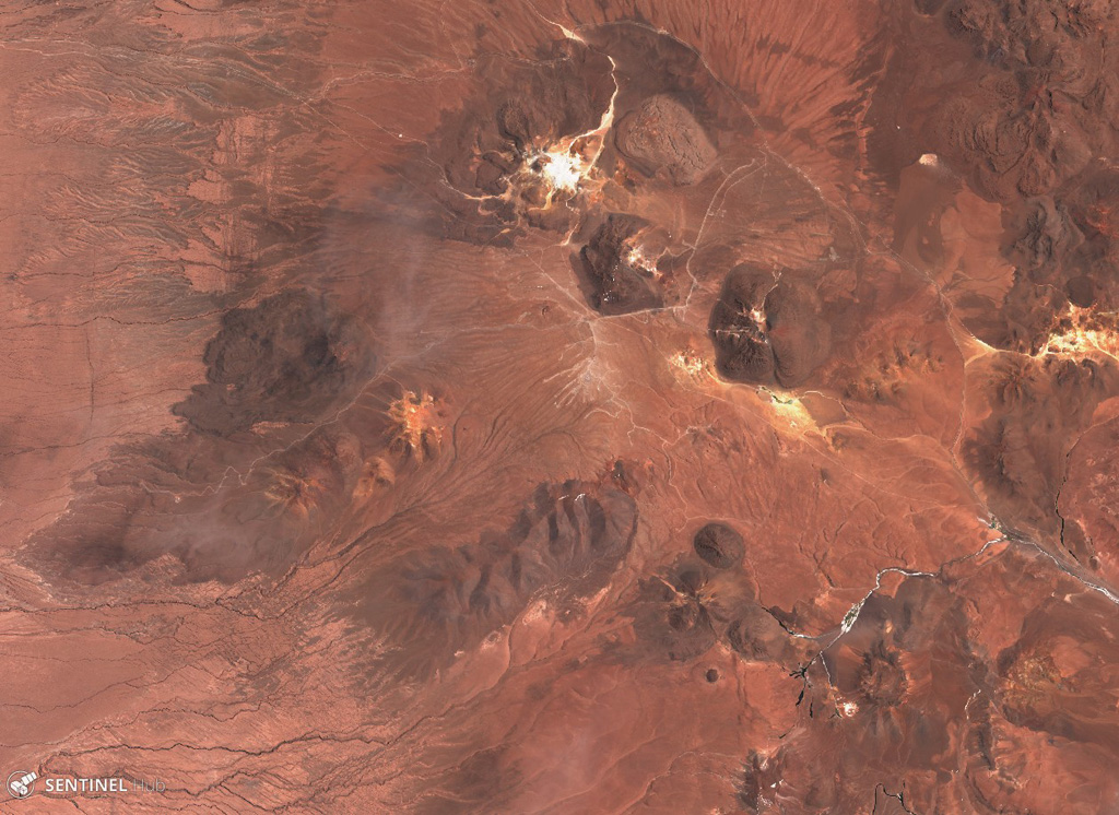
The Cerro Purico complex is shown in this 5 November 2019 Sentinel-2 satellite image (N is at the top; the image is approximately 43 km across). The dome containing white material at the top is Cerro Toco, then towards the SW is Cerro Chajnantor and Cerro Chascón. The dark lava flow to the W was erupted from Cerro Negro, then towards the SW is Cerros de Macon, Cerro Putas, and Cerro Aspero, and the edifice with the crater in the SW corner is Alitar.
Satellite image courtesy of Copernicus Sentinel Data, 2019.
![]() This image is made available under the Creative Commons BY-SA 4.0 license terms.
This image is made available under the Creative Commons BY-SA 4.0 license terms.
Keywords: lava flow
Purico Complex