Global Volcanism Program | Image GVP-12347
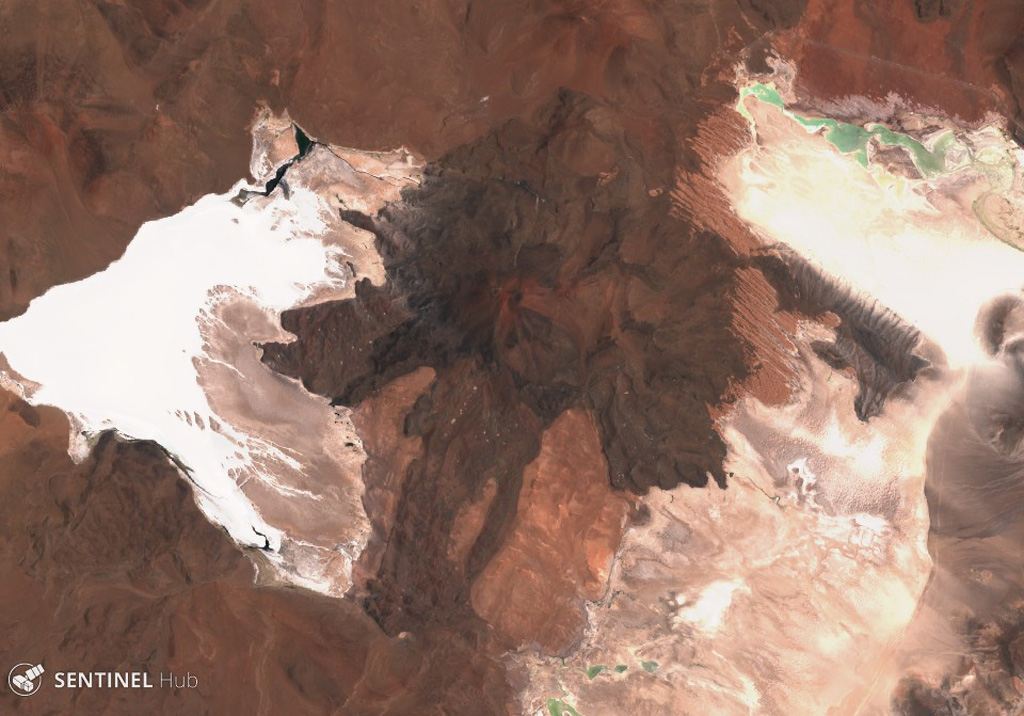
Caichinque is between the Salar Capur (left) and Salar Talar (right) lakes, seen here in this 22 November 2019 Sentinel-2 satellite image (N is at the top). More than six vents have produced lava flows, with the one to the south reaching 6 km.
Satellite image courtesy of Copernicus Sentinel Data, 2019.
![]() This image is made available under the Creative Commons BY-SA 4.0 license terms.
This image is made available under the Creative Commons BY-SA 4.0 license terms.
Keywords: lava flow
Caichinque