Global Volcanism Program | Image GVP-12389
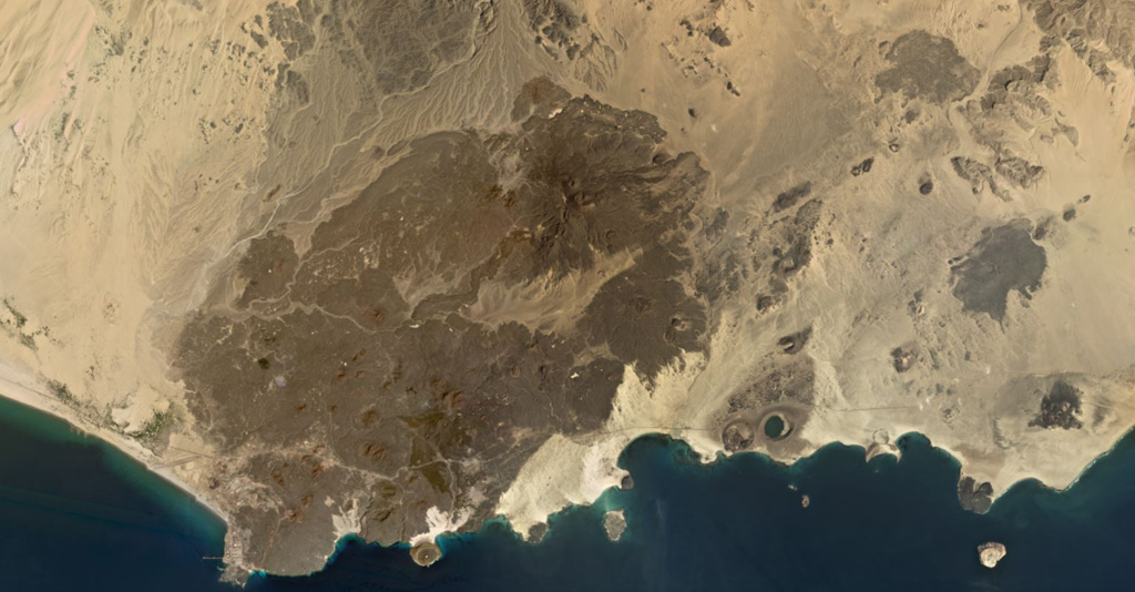
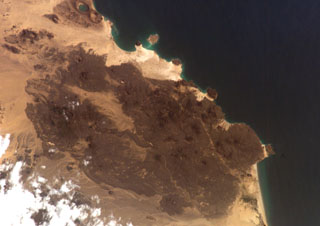
The 500 km2 Balhaf-Bir Ali Volcanic Field in south Yemen is shown in this February 2020 Planet Labs satellite image monthly mosaic (N is at the top; this image is approximately 45 km across). The field largely comprises lava flows and spatter and scoria cones, tuff rings, and the At-Tabâb maar with a crater lake along the shoreline. The Balhaf cone is the darker area to the S with the cross-roads just below it, and the darker area in the northern part of the field is the Jabal Ba Masha’ib.
Satellite image courtesy of Planet Labs Inc., 2020 (https://www.planet.com/).
Copyrighted image used with permission. All Rights Reserved. Contact photographer for any usage requests.
Keywords: volcanic field | lava flow | remote sensing
Balhaf-Bir Ali Volcanic Field