Image GVP-12411
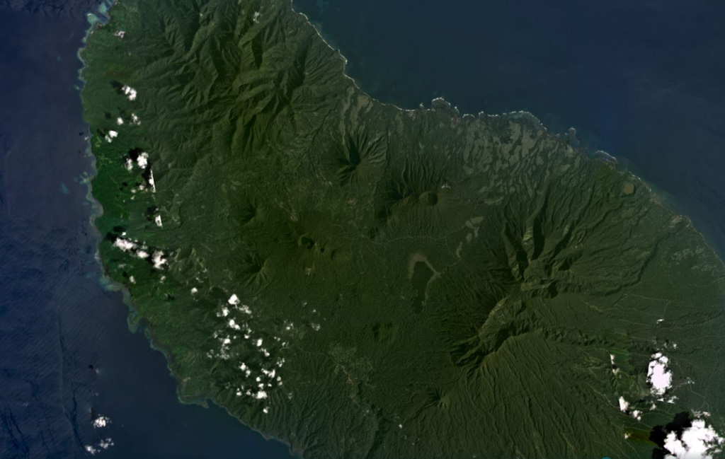
Umboi Island is around 50 km long in the NW-SE direction and has volcanic features visible in the NW, in the center of this January 2021 Planet Labs satellite image monthly mosaic (N is at the top; this image is approximately 40 km across). The larger crater near the top of the center of the island (N of the lake) is Bono of Soal volcano, and W is the eroded Barik cone. S of that is a NNW-SEE trend of craters named Pung, Talo, Apalong, and Tanglup from W to E.
Satellite image courtesy of Planet Labs Inc., 2021 (https://www.planet.com/).
Copyrighted image used with permission. All Rights Reserved. Contact photographer for any usage requests.
Keywords: stratovolcano | crater
Umboi