Global Volcanism Program | Image GVP-12412
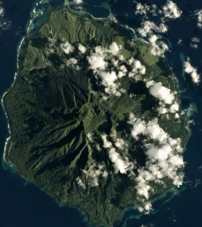
The 7.5 x 9 km Sakar is the NE-most of a chain of volcanic islands off the northern coast of Papua New Guinea, seen in this February 2017 Planet Labs satellite image monthly mosaic (N is at the top). The flanks are deeply eroded, but the summit crater contains a lake in the SE section and there is a cone on the S flank.
Satellite image courtesy of Planet Labs Inc., 2017 (https://www.planet.com/).
Copyrighted image used with permission. All Rights Reserved. Contact photographer for any usage requests.
Keywords: island volcano | crater
Sakar