Due to the US Government shutdown, the Smithsonian is temporarily closed. The Global Volcanism Program website will remain available but will not be monitored or updated. Status updates will be available on the Smithsonian homepage.
Logo link to homepage

Image GVP-12488

Beyond the NW tip of Lake Baikal is the Tunkin (or Tunka) Depression volcanic field, shown in this September 2019 Planet Labs satellite image monthly mosaic (N is at the top; this image is approximately 170 km across). The field is the surface manifestation of a rift zone and contains five main groups of scoria cones and lava flows that were produced during the late-Pleistocene to Holocene. Satellite image courtesy of Planet Labs Inc., 2019 (https://www.planet.com/).

Beyond the NW tip of Lake Baikal is the Tunkin (or Tunka) Depression volcanic field, shown in this September 2019 Planet Labs satellite image monthly mosaic (N is at the top; this image is approximately 170 km across). The field is the surface manifestation of a rift zone and contains five main groups of scoria cones and lava flows that were produced during the late-Pleistocene to Holocene.

Satellite image courtesy of Planet Labs Inc., 2019 (https://www.planet.com/).

Copyrighted image used with permission. All Rights Reserved. Contact photographer for any usage requests.

Keywords: volcanic field | rift zone
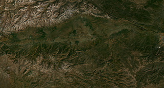

Tunkin Depression