Global Volcanism Program | Image GVP-12531
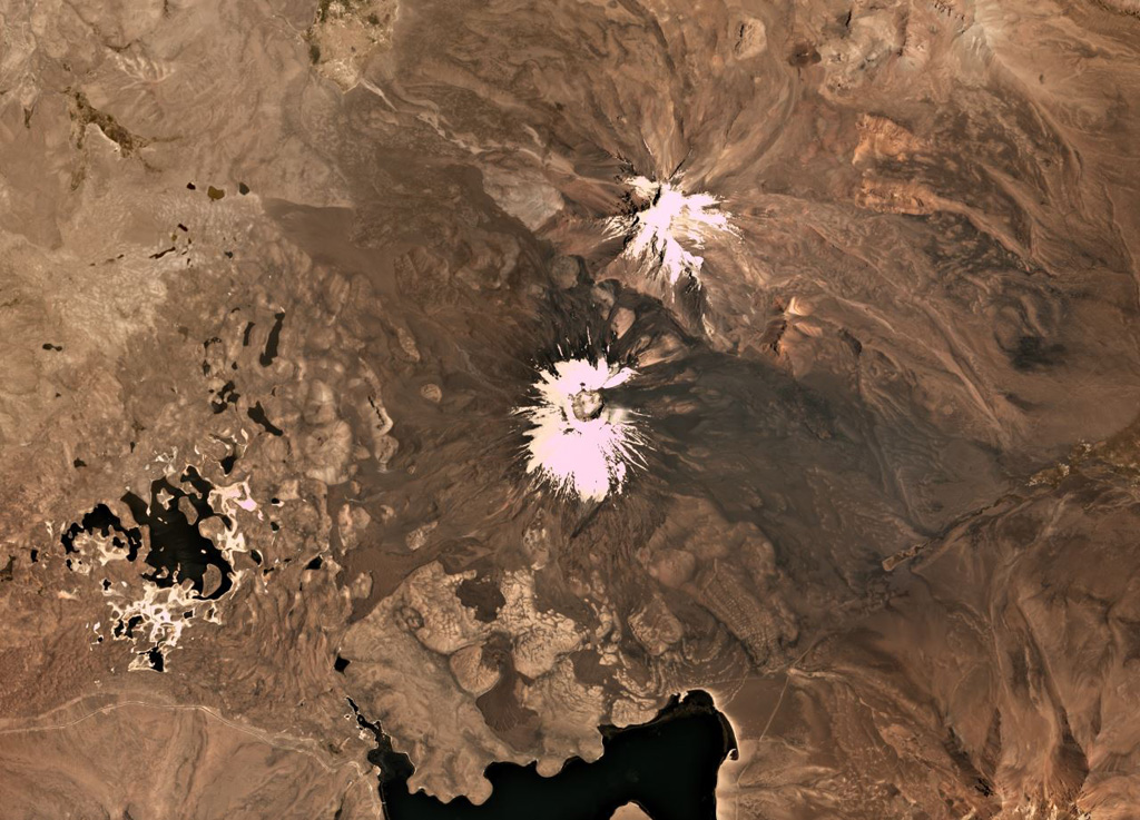
Parinacota is the larger of the two main edifices in this November 2019 Planet Labs satellite image monthly mosaic (N is at the top; this image is approximately 23 km across). With Pomerape to the NE, together they form the Nevados de Payachata group along the Chile-Bolivia border. The group of lakes to the SW formed within a debris avalanche deposit about 8,000 years ago that is more than 22 km long with a volume of 6 km3. The current cone formed over the resulting scarp and older edifice, and has a summit crater around 650 m wide. Lava flows are visible on all flanks, with some flows emplaced around the debris avalanche deposit hummocks.
Satellite image courtesy of Planet Labs Inc., 2019 (https://www.planet.com/).
Copyrighted image used with permission. All Rights Reserved. Contact photographer for any usage requests.
Galleries: Debris Avalanches / Landslides
Keywords: landslide | sector collapse | hummock | debris avalanche deposit | stratovolcano | crater | lava flow
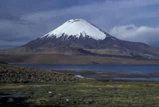
Parinacota