Global Volcanism Program | Image GVP-12553
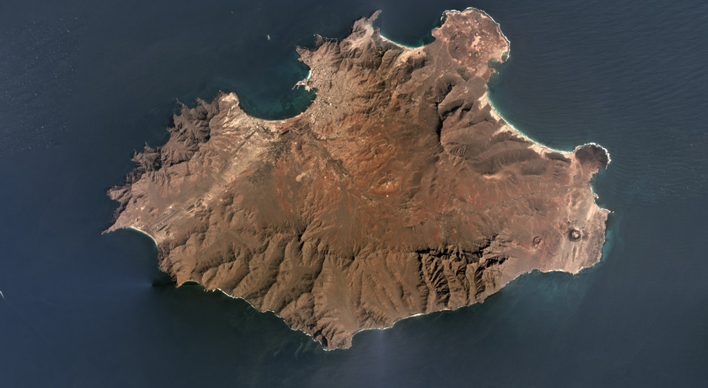
The 25-km-wide Pliocene-Pleistocene São Vicente is shown in this February 2019 Planet Labs satellite image monthly mosaic (N is at the top). The products of the most recent volcanism are at the two NE peninsulas (northern Baia das Gatas and eastern Calhau) and the far-eastern area. The two small cones near the eastern coastline are Vulcãno Viana (right) and Curral de João Paula (left). The linear ridge in the NE area is Monte Verde.
Satellite image courtesy of Planet Labs Inc., 2019 (https://www.planet.com/).
Copyrighted image used with permission. All Rights Reserved. Contact photographer for any usage requests.
Keywords: erosion | scoria cone | island volcano
Sao Vicente