Global Volcanism Program | Image GVP-12640
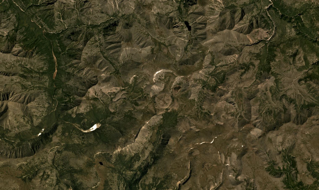
The Udokan Plateau volcanic field extends across 3,000 km2 around 400 km ENE of the northern tip of Lake Baikal, with a small part of the field that contains Holocene features shown in this July 2019 Planet Labs satellite image monthly mosaic (N is at the top; this image is approximately 16.5 km across). The round, 950-m-diameter lava dome in the center of this image is just SW of the Aku crater. Chepe cone is in the NW corner, and between them is Dolinnyi cone.
Satellite image courtesy of Planet Labs Inc., 2019 (https://www.planet.com/).
Copyrighted image used with permission. All Rights Reserved. Contact photographer for any usage requests.
Keywords: lava dome | volcanic field
Udokan Plateau