Image GVP-12660
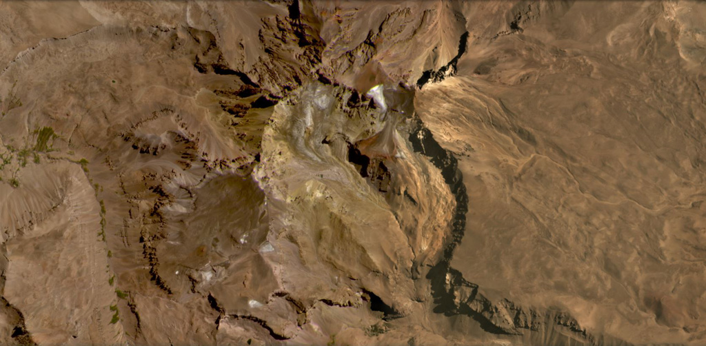
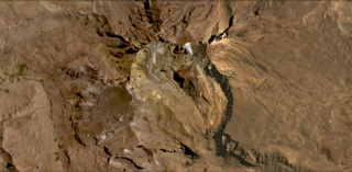
Risco Plateado covers an area of 910 km2 and has a steep mountainous relief partly due to glacial erosion, shown in this February 2021 Planet Labs satellite image monthly mosaic (N is at the top; this image is approximately 15 km across). there is a scoria cone on the SE flank, visible in the lower right corner of the image.
Satellite image courtesy of Planet Labs Inc., 2021 (https://www.planet.com/).
Copyrighted image used with permission. All Rights Reserved. Contact photographer for any usage requests.
Keywords: erosion
Risco Plateado