Akan (Japan) | 17 September-23 September 2025 | New Activity / Unrest
 Cite this Report Cite this Report
|
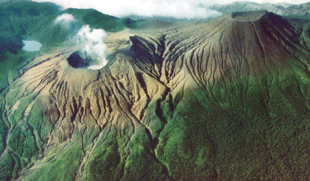
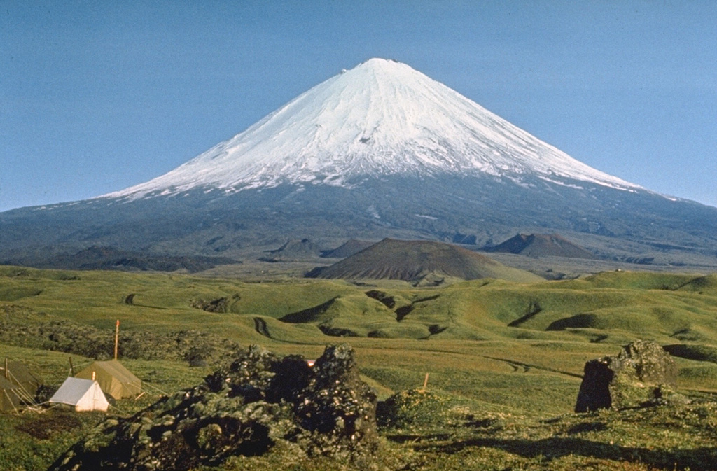
 Akan Akan
Kuril Volcanic Arc
|
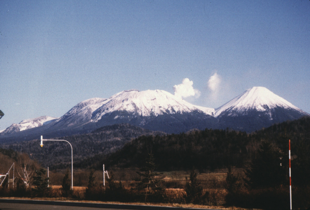
The Japan Meteorological Agency (JMA) reported eruptive activity at Me-Akan (also known as Meakan-dake, which means Meakan Peak) of the Akan volcanic complex during 16-23 September. Seismicity near Ponmachineshiri Crater that increased on 11 September continued to fluctuate at elevated levels. The seismic network recorded 27-50 daily volcanic earthquakes. Tilt in the direction of the crater continued at a low rate. Minor ashfall around the crater was visible on 16 September. During 17-23 September the volume of white steam-and-gas plumes rising from 96-1 Crater within Ponmachineshiri continued to be high; the plumes rose 200-800 m above the crater rim and drifting E and SE. The Alert Level remained at 2 (the second lowest level on a 5-level scale) and the public was warned to exercise caution within 500 m of Ponmachineshiri Crater.
Source: Japan Meteorological Agency (JMA)
|
Bur ni Telong (Indonesia) | 17 September-23 September 2025 | New Activity / Unrest
Cite this Report
|
 Bur ni Telong Bur ni Telong
Sunda Volcanic Arc
|
The Pusat Vulkanologi dan Mitigasi Bencana Geologi (PVMBG) reported increased unrest at Bur ni Telong. The number of deep volcanic earthquakes increased on 10, 15, and 22 September. Additionally, earthquakes with magnitudes of 2-3 were recorded by the seismic network and felt in several locations around the volcano. The Alert Level was raised to 2 (on a scale from 1 to 4) at 2100 on 22 September. The public was advised to maintain a minimum distance of 1.5 km from the crater area and to avoid the fumarole and solfatara regions, especially during cloudy or rainy weather.
Source: Pusat Vulkanologi dan Mitigasi Bencana Geologi (PVMBG, also known as CVGHM)
|
Kanlaon (Philippines) | 17 September-23 September 2025 | New Activity / Unrest
Cite this Report
|
 Kanlaon Kanlaon
Negros-Sulu Volcanic Arc
|
The Philippine Institute of Volcanology and Seismology (PHIVOLCS) reported continuing eruptive activity at Kanlaon during 16-23 September. The seismic network recorded 4-60 daily volcanic earthquakes. Gas-and-steam emissions of variable densities rose 75-600 m above the crater rim and drifted N, NE, and SE; views were obscured on 22 September. Sulfur dioxide emissions ranged from 797 to 1,996 tonnes per day. Two periods of ash emissions, lasting two and 69 minutes long, were visible on 17 September. The Alert Level remained at 2 (on a scale of 0-5); the public was warned to stay out of the 4-km-radius Permanent Danger Zone (PDZ) and pilots were advised to avoid flying close to the summit.
Source: Philippine Institute of Volcanology and Seismology (PHIVOLCS)
|
Lokon-Empung (Indonesia) | 17 September-23 September 2025 | New Activity / Unrest
Cite this Report
|
 Lokon-Empung Lokon-Empung
Sangihe Volcanic Arc
|
The Pusat Vulkanologi dan Mitigasi Bencana Geologi (PVMBG) reported continuing unrest at Lokon-Empung during 17-23 September. Daily white steam-and-gas plumes rose as high as 100 m above the Tompaluan Crater rim and drifted in multiple directions. Incandescence at the crater was visible on 17 September. The Alert Level remained at 3 (on a scale of 1-4) and the public was warned to stay 2.5 km away from Tompaluan Crater.
Source: Pusat Vulkanologi dan Mitigasi Bencana Geologi (PVMBG, also known as CVGHM)
|
Rincon de la Vieja (Costa Rica) | 17 September-23 September 2025 | New Activity / Unrest
Cite this Report
|
 Rincon de la Vieja Rincon de la Vieja
Central America Volcanic Arc
|
The Observatorio Vulcanologico y Sismologico de Costa Rica-Universidad Nacional (OVSICORI-UNA) reported that at 1944 on 21 September an eruption at Rincón de la Vieja ejected incandescent ballistics above the crater rim. The event was recorded in both infrasound and seismic data. Darkness obscured any plume. A small white plume was visible in webcam views during 22-23 September.
Source: Observatorio Vulcanologico y Sismologico de Costa Rica-Universidad Nacional (OVSICORI-UNA)
|
Sabancaya (Peru) | 17 September-23 September 2025 | New Activity / Unrest
Cite this Report
|
 Sabancaya Sabancaya
Central Andean Volcanic Arc
|
The Instituto Geofísico del Perú’s (IGP) Centro Vulcanológico Nacional (CENVUL) reported that daily gas-and-steam plumes at Sabancaya rose 500-1,600 m above the crater rim and drifted less than 10 km N, NE, and E during 17-22 September. Sulfur dioxide emissions were at low levels, averaging 131 tons per day. Thermal anomalies on the summit crater floor were detected during 20-21 September. The Alert Level remained at Orange (the third level on a four-color scale) and the public was warned to stay outside of a 12 km radius from the summit.
Source: Instituto Geofísico del Perú (IGP)
|
Aira (Japan) | 17 September-23 September 2025 | Continuing ActivityCite this Report |
 Aira Aira
Ryukyu Volcanic Arc
|
The Japan Meteorological Agency (JMA) reported ongoing eruptive activity at Minamidake Crater (Aira Caldera’s Sakurajima volcano) during 15-22 September. Nightly crater incandescence was visible in webcam images. Small eruptive events were occasionally recorded. Sulfur dioxide emissions were characterized as slightly high, averaging 1,700 tons per day on 19 September. The Alert Level remained at 3 (on a 5-level scale), and the public was warned to be cautious within 2 km of both the Minimadake and Showa craters.
Source: Japan Meteorological Agency (JMA)
|
Bezymianny (Russia) | 17 September-23 September 2025 | Continuing ActivityCite this Report |
 Bezymianny Bezymianny
Eastern Kamchatka Volcanic Arc
|
The Kamchatkan Volcanic Eruption Response Team (KVERT) reported that a thermal anomaly over Bezymianny was identified in satellite images during 12-13 and 17-18 September; weather clouds obscured views on the other days. According to the Tokyo VAAC re-suspended that was ash deposited during previous eruptions drifted SW on 17 September. The Aviation Color Code remained at Yellow (the second lowest level on a four-color scale). Dates are reported in UTC; specific events are in local time where noted.
Sources: Kamchatkan Volcanic Eruption Response Team (KVERT), Tokyo Volcanic Ash Advisory Center (VAAC)
|
Dukono (Indonesia) | 17 September-23 September 2025 | Continuing ActivityCite this Report |
 Dukono Dukono
Halmahera Volcanic Arc
|
The Pusat Vulkanologi dan Mitigasi Bencana Geologi (PVMBG) reported that eruptive activity at Dukono continued during 17-23 September. White-and-gray gas-and-ash plumes rose as high as 800 m above the summit on most days and drifted in multiple directions; plumes were not visible on 23 September. The Alert Level remained at Level 2 (on a scale of 1-4) and the public was warned to stay 4 km away from the Malupang Warirang Crater.
Source: Pusat Vulkanologi dan Mitigasi Bencana Geologi (PVMBG, also known as CVGHM)
|
Fuego (Guatemala) | 17 September-23 September 2025 | Continuing ActivityCite this Report |
 Fuego Fuego
Central America Volcanic Arc
|
The Instituto Nacional de Sismología, Vulcanologia, Meteorologia e Hidrología (INSIVUMEH) reported that eruptive activity at Fuego continued during 16-23 September. Daily Strombolian explosions were recorded by the seismic network at rates of 5-12 per hour. The explosions generated daily gas-and-ash plumes that rose as high as 1.1 km above the summit and drifted 10-30 km in multiple directions. Occasional rumbling sounds, shock waves, and/or sound associated with gas emissions were reported. Explosions ejected incandescent material 100-200 m above the summit during 16-17 and 21-22 September and showered the upper flanks with incandescent material during 21-22 September. Block avalanches descended the flanks, including the Las Lajas (SE), Seca (W), Taniluya (SSW), Trinidad (SSW), Santa Teresa (W), and Ceniza (SSW) drainages, sometimes reaching vegetated areas. Occasional ashfall was reported in areas downwind including Panimache I and II (8 km SW), Morelia (9 km SW), and Santa Sofía (12 km SW) and local areas to the NE.
Heavy rain generated lahars in multiple drainages during 17-19 September. Lahars descended the Ceniza, Zarco, and Mazate drainages based on a special report issued 1359 on 17 September, and the Seca and Mineral drainages based on a report issued at 1659 that same day. Special reports issued at 1430, 1445, and 1523 on 18 September noted that lahars descended the El Jute (ESE), Las Lajas, Ceniza, Zarco, Mazate, Seca, and Mineral (W) drainages. In the early afternoon on 19 September lahars descended the El Jute and Las Lajas drainages and the Ceniza, Zarco, and Mazate drainages based on reports issued at 1455 and 1505, respectively. Later that day hot lahars with a sulfur odor descended the El Jute and Las Lajas drainages, based on a report issued at 2010. All of the lahars were characterized as a mixture of water and sediment that carried tree branches, trunks, and blocks possibly as large as 3 m in diameter.
Source: Instituto Nacional de Sismologia, Vulcanologia, Meteorologia, e Hidrologia (INSIVUMEH)
|
Great Sitkin (United States) | 17 September-23 September 2025 | Continuing ActivityCite this Report |
 Great Sitkin Great Sitkin
Aleutian Ridge Volcanic Arc
|
The Alaska Volcano Observatory (AVO) reported that slow lava effusion continued to feed a thick flow in Great Sitkin’s summit crater during 16-23 September. Satellite data indicated that the SE part of the flow slightly inflated at a rate of about 5 meters of surface motion per day, though the distal margin of the flow did not advance. Small earthquakes were detected by the seismic network daily or nearly daily. Weather clouds sometimes obscured satellite and webcam views; elevated surface temperatures were identified in satellite data during 21-22 September. Towards the end of the week radar satellite images showed advancement of the SW part of the lava flow and associated rockfalls at the flow’s margins. The Volcano Alert Level remained at Watch (the third level on a four-level scale) and the Aviation Color Code remained at Orange (the third color on a four-color scale).
Source: US Geological Survey Alaska Volcano Observatory (AVO)
|
Ibu (Indonesia) | 17 September-23 September 2025 | Continuing ActivityCite this Report |
 Ibu Ibu
Halmahera Volcanic Arc
|
The Pusat Vulkanologi dan Mitigasi Bencana Geologi (PVMBG) reported that the eruption at Ibu continued during 17-23 September. Dense gray or white-and-gray ash plumes rose 400-700 m above the summit and drifted W, NW, and NE. Incandescence at the summit was visible in several nighttime webcam images. The Alert Level remained at 2 (the second lowest level on a four-level scale) and the public was advised to stay 2 km away from the active crater and 3.5 km away from the N crater wall opening.
Source: Pusat Vulkanologi dan Mitigasi Bencana Geologi (PVMBG, also known as CVGHM)
|
Karymsky (Russia) | 17 September-23 September 2025 | Continuing ActivityCite this Report |
 Karymsky Karymsky
Eastern Kamchatka Volcanic Arc
|
The Kamchatkan Volcanic Eruption Response Team (KVERT) reported that moderate activity continued at Karymsky during 11-18 September. A thermal anomaly was identified in satellite images on 12 September; weather clouds obscured views on the other days. The Aviation Color Code remained at Orange (the third level on a four-color scale). Dates and times are provided in Coordinated Universal Time (UTC); specific events are indicated in local time where specified.
Source: Kamchatkan Volcanic Eruption Response Team (KVERT)
|
Katmai (United States) | 17 September-23 September 2025 | Continuing ActivityCite this Report |
 Katmai Katmai
Alaska Peninsula Volcanic Arc
|
The Alaska Volcano Observatory (AVO) reported that on 22 September strong winds in the vicinity of Katmai and the Valley of Ten Thousand Smokes dispersed unconsolidated ash up to 1.8 km (6,000 ft) a.s.l. to the SE. The ash was originally deposited during the Novarupta-Katmai eruption in 1912. The Volcano Alert Level remained at Normal (the lowest level on a four-level scale) and the Aviation Color Code remained at Green (the lowest level on a four-color scale).
Source: US Geological Survey Alaska Volcano Observatory (AVO)
|
Kilauea (United States) | 17 September-23 September 2025 | Continuing ActivityCite this Report |
 Kilauea Kilauea
Hawaiian-Emperor Hotspot Volcano Group
|
The Hawaiian Volcano Observatory (HVO) reported that the eruption within Kilauea’s Kaluapele summit caldera, characterized by episodic fountaining, incandescence, and intermittent spatter from craters along the SW margin of Halema’uma’u Crater, continued at variable levels during 16-23 September. Incandescence at both the N and S vents was visible overnight during 16-17 September. Gas pistoning (a shallow, gas-driven rise and fall of a lava surface) at the N vent was followed by brief overflows of lava beginning at 0838 on 17 September. Overflows became larger during 17-18 September and dome fountains that were 3-6 m high accompanied the filling and overflowing of the vent. Drainbacks of lava were marked by energetic bursts of gas that sent spatter 5-10 m high and landed on the outside of the cone. Continuous low lava fountains began at approximately 0244 on 19 September and intensified until 0311, when fountains rose up to 150 m and large lava flows began advancing onto the crater floor. An eruption plume rose 3 km above the ground surface and drifted SW. Fountains initially rose as high as 240 m but by 0921 they were just over 100 m high and inclined about 60 degrees towards the E. The S vent began erupting at unspecified time then stopped at around 0600. After nine hours of continuous fountaining at the N vent, the eruption abruptly ended at 1208. Approximately 6.3 million cubic meters of lava had erupted, and lava flows covered about two thirds of the Halema’uma’u Crater floor. Minor incandescence was recorded daily at the S vent, and during most days at the N vent, during 20-23 September. Gas plumes continued to be emitted from the vents.
Source: US Geological Survey Hawaiian Volcano Observatory (HVO)
|
Klyuchevskoy (Russia) | 17 September-23 September 2025 | Continuing ActivityCite this Report |
 Klyuchevskoy Klyuchevskoy
Eastern Kamchatka Volcanic Arc
|
The Kamchatkan Volcanic Eruption Response Team (KVERT) reported that ash deposited on the N flank of Klyuchevskoy during previous eruptions was resuspended by strong winds and drifted more than 575 km SE on 23 September. The Aviation Color Code was raised to Yellow (the second lowest level on a four-color scale). Dates and times are provided in Coordinated Universal Time (UTC); specific events are indicated in local time where specified.
Source: Kamchatkan Volcanic Eruption Response Team (KVERT)
|
Krasheninnikov (Russia) | 17 September-23 September 2025 | Continuing ActivityCite this Report |
 Krasheninnikov Krasheninnikov
Eastern Kamchatka Volcanic Arc
|
The Kamchatkan Volcanic Eruption Response Team (KVERT) reported that the eruption at Krasheninnikov continued during 11-18 September. A daily large thermal anomaly over the volcano was identified in satellite images. A thermal anomaly in Northern Cone and over two active lava flows on the E flank were visible in Sentinel satellite images during 13 and 17-18 September. Dates and times are provided in Coordinated Universal Time (UTC); specific events are indicated in local time where specified.
Sources: Kamchatkan Volcanic Eruption Response Team (KVERT), Copernicus
|
Kuchinoerabujima (Japan) | 17 September-23 September 2025 | Continuing ActivityCite this Report |
 Kuchinoerabujima Kuchinoerabujima
Ryukyu Volcanic Arc
|
The Japan Meteorological Agency (JMA) reported that the number of shallow volcanic earthquakes at Kuchinoerabujima began to decline in July and remained low. Visits to the volcano on 7 and 9 September confirmed no notable changes to hydrothermal fields in and around Furudake Crater and Shindake Crater (just N of Furudake) and no emissions were visible. The Alert Level was lowered to 1 (on a scale of 1-5) at 1100 on 19 September.
Source: Japan Meteorological Agency (JMA)
|
Lewotobi (Indonesia) | 17 September-23 September 2025 | Continuing ActivityCite this Report |
 Lewotobi Lewotobi
Sunda Volcanic Arc
|
The Pusat Vulkanologi dan Mitigasi Bencana Geologi (PVMBG) reported that on 19 September the seismic network at Lewotobi Laki-laki recorded an increase in the number of low-frequency earthquakes, followed by an eruption at 1432 that produced ash plumes that rose 500-1,000 m above the summit. The Alert Level was raised to 4 (the highest level on a scale of 1-4) at 2100 and the exclusion zone was increased to 6 km from the center of Laki-laki and 7 km in a semicircle clockwise from the SW to the NE. At 2158 eruptive activity became continuous and remained continuous at least through 2229, with ash plumes rising 800-1,500 m above the summit and drifting SW. At 2246 an ash plume rose around 6 km above the summit and drifted W and SW and a webcam at that same time showed incandescent material on the upper flanks. Incandescent material being ejected straight up above the summit and falling onto the upper flanks was visible in a 2254 webcam image. Ash plumes rose 3 km above the summit and drifted W and SW at 2307, at 2327, and at 2341. Ash-and-gas emissions were continuous for most of 20 September. Multiple eruptive events produced ash plumes that rose as high as 3 km above the summit and drifted NW, W, and SW. Summit incandescence was visible in a few of the webcam images. According to a news report three flights using the Komodo International Airport, around 300 km W, were canceled on 20 September and two were rescheduled for the next day. Multiple eruptive events were recorded on 21 September. Ash plumes again rose as high as 3 km above the summit and drifted N, NW, W, and SW. Ash plumes during 22-23 September rose 600-2,000 m above the summit and drifted NW, W, and SW. Minor incandescence at the summit was visible in a webcam image at 1915 on 22 September.
Sources: Pusat Vulkanologi dan Mitigasi Bencana Geologi (PVMBG, also known as CVGHM), Antara News
|
Lewotolok (Indonesia) | 17 September-23 September 2025 | Continuing ActivityCite this Report |
 Lewotolok Lewotolok
Sunda Volcanic Arc
|
The Pusat Vulkanologi dan Mitigasi Bencana Geologi (PVMBG) reported that an eruption at Lewotolok was ongoing during 17-23 September. On most days white-and-gray ash plumes rose 300-600 m above the summit of the cone and drifted W and NW; only white plumes were observed on 21 and 23 September. Several nighttime webcam images showed Strombolian ejections of incandescent material above the cone and onto the flanks. The Alert Level remained at 3 (on a scale of 1-4) and the public was warned to stay 3 km away from the summit.
Source: Pusat Vulkanologi dan Mitigasi Bencana Geologi (PVMBG, also known as CVGHM)
|
Marapi (Indonesia) | 17 September-23 September 2025 | Continuing ActivityCite this Report |
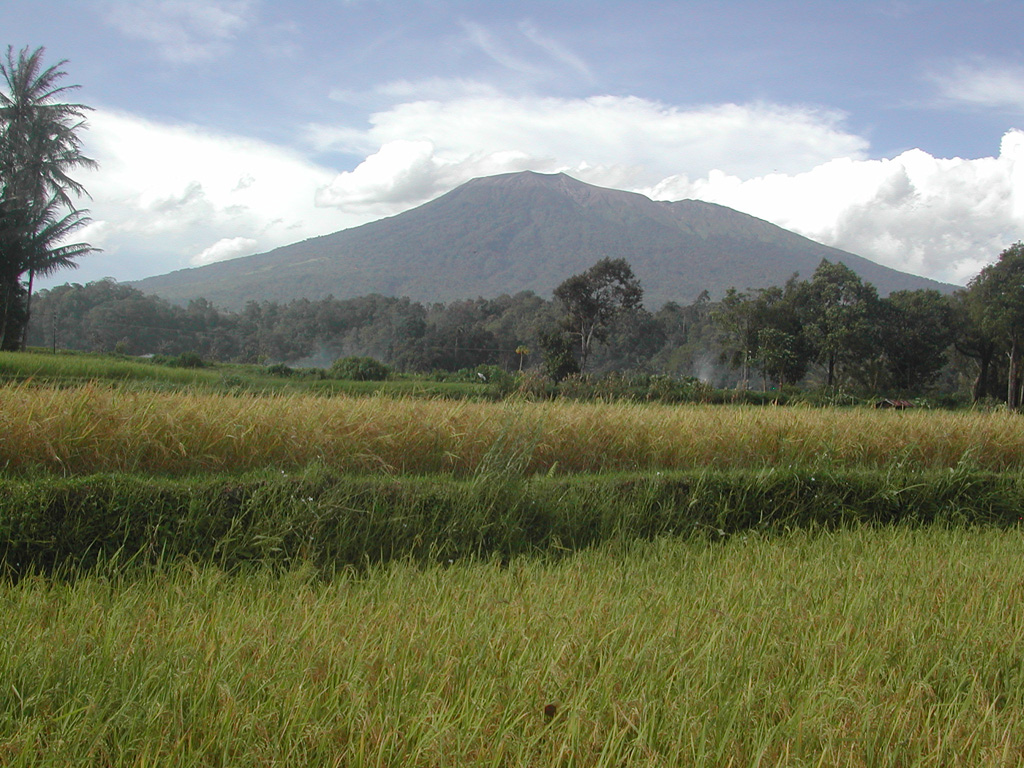 Marapi Marapi
Sunda Volcanic Arc
|
The Pusat Vulkanologi dan Mitigasi Bencana Geologi (PVMBG) reported that eruptive activity at Marapi (on Sumatra) continued during 17-23 September. Almost daily white steam-and-gas plumes rose as high as 200 m above the crater rim and drifted in multiple directions. Eruptive events were recorded on 17, 22, and 23 September, but weather conditions prevented visual confirmation. Dense gray ash plumes rose 1 km above the summit and drifted S and SW during 20-21 September. The Alert Level remained at 2 (on a scale of 1-4) and the public was warned to stay 3 km away from the active crater.
Source: Pusat Vulkanologi dan Mitigasi Bencana Geologi (PVMBG, also known as CVGHM)
|
Merapi (Indonesia) | 17 September-23 September 2025 | Continuing ActivityCite this Report |
 Merapi Merapi
Sunda Volcanic Arc
|
The Balai Penyelidikan dan Pengembangan Teknologi Kebencanaan Geologi (BPPTKG) reported that the eruption at Merapi (on Java) continued during 12-18 September. Earthquakes were less intense compared to the previous week. The SW lava dome produced 11 lava avalanches that traveled as far as 2 km SW down the Bebeng drainage, 36 that traveled as far as 2 km SW down the Krasak drainage, and 62 that traveled as far as 2 km W down the Sat/Putih drainage. One pyroclastic flow traveled 2 km down the Krasak drainage. Small morphological changes to the SW lava dome resulted from lava effusion and minor collapses. The Alert Level remained at 3 (on a scale of 1-4), and the public was warned to stay 3-7 km away from the summit, based on location.
Source: Balai Penyelidikan dan Pengembangan Teknologi Kebencanaan Geologi (BPPTKG)
|
Nyamulagira (DR Congo) | 17 September-23 September 2025 | Continuing ActivityCite this Report |
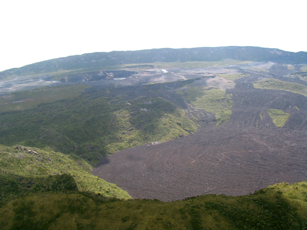 Nyamulagira Nyamulagira
Albertine Rift Volcanic Province
|
The eruption at Nyamulagira continued during 3-18 September. Incandescence on the floor of the summit caldera and from active lava flows on the W and NW flanks was visible in satellite images on 3, 8, 13, and 18 September. Weather clouds obscured parts of the summit area and the flanks in all four images.
Source: Copernicus
|
Popocatepetl (Mexico) | 17 September-23 September 2025 | Continuing ActivityCite this Report |
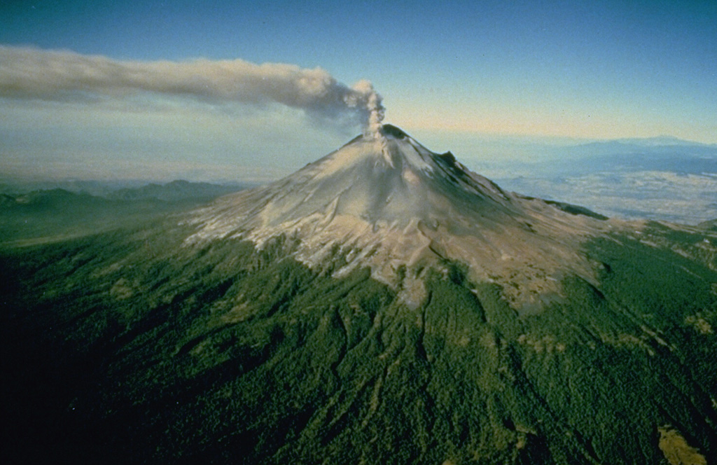 Popocatepetl Popocatepetl
Trans-Mexican Volcanic Arc
|
The Centro Nacional de Prevención de Desastres (CENAPRED) reported that eruptive activity continued at Popocatépetl during 16-23 September. The seismic network recorded 32-80 long-period events per day, accompanied by steam-and-gas emissions with occasional minor ash content. In addition, the seismic network recorded daily periods of low-amplitude tremor, characterized by harmonic tremor and high-frequency signals, lasting from two hours and 52 minutes to 7 hours and 42 minutes. A minor explosion was recorded at 0148 on 22 September. A webcam image from 0149 showed a small amount of incandescent material on the upper flanks. An explosion at 0049 on 23 September also ejected incandescent material a short distance onto the upper flank. According to the Washington VAAC ash plumes visible in webcam and/or satellite images during 16-18 and 20-22 September rose 5.8-6.7 km (20,000-22,000 ft) a.s.l. (about 400-1,300 m above the crater rim) and drifted as far as 46 km W, WSW, and SW. The Alert Level remained at Yellow, Phase Two (the middle level on a three-color scale) and the public was warned to stay 12 km away from the crater.
Sources: Centro Nacional de Prevencion de Desastres (CENAPRED), Washington Volcanic Ash Advisory Center (VAAC)
|
Santa Maria (Guatemala) | 17 September-23 September 2025 | Continuing ActivityCite this Report |
 Santa Maria Santa Maria
Central America Volcanic Arc
|
The Instituto Nacional de Sismología, Vulcanología, Meteorología e Hidrología (INSIVUMEH) reported high levels of ongoing eruptive activity at Santa Maria’s Santiaguito dome complex during 16-23 September, with continuing lava extrusion at Caliente dome. Daily explosions, 2-6 per hour when reported, generated gas-and-ash plumes that rose 700-1,000 m above the dome and drifted in multiple directions. Effusion of blocky lava and collapses of previous deposits produced block avalanches that descended mainly the W and SW flanks; the collapsed material produced short pyroclastic density currents during 22-23 September. Incandescence during dark hours was visible from Caliente dome and block avalanches. Special reports issued at 1305 on 16 September and at 1337 on 20 September noted that heavy rainfall generated hot lahars in the Cabello de Ángel drainage (SE). The lahars were a mixture of water and sediments, along with tree trunks, branches, and blocks up to 3 m in diameter, and a sulfur odor. Hot lahars moving down the Tambor drainage (SSW) were noted in special reports issued at 1317 on 16 September, at 1345 on 18 September, and at 1346 on 20 September. These lahars were also a mixture of water and sediments, with tree trunks, branches, and blocks up to 1 m in diameter, and a sulfur odor.
Source: Instituto Nacional de Sismologia, Vulcanologia, Meteorologia, e Hidrologia (INSIVUMEH)
|
Semeru (Indonesia) | 17 September-23 September 2025 | Continuing ActivityCite this Report |
 Semeru Semeru
Sunda Volcanic Arc
|
The Pusat Vulkanologi dan Mitigasi Bencana Geologi (PVMBG) reported that activity continued at Semeru during 17-23 September, with daily eruptive events recorded by the seismic network. White-and-gray ash plumes rose 300-700 m above the summit and drifted in multiple directions during 22-23 September. Emissions were not visible on the other days. The Alert Level remained at 2 (the second lowest level on a scale of 1-4). The public was warned to stay at least 3 km away from the summit in all directions, 8 km from the summit to the SE, 500 m from the banks of the Kobokan drainage as far as 13 km from the summit, and to avoid other drainages including the Bang, Kembar, and Sat, due to lahar, avalanche, and pyroclastic flow hazards.
Source: Pusat Vulkanologi dan Mitigasi Bencana Geologi (PVMBG, also known as CVGHM)
|
Sheveluch (Russia) | 17 September-23 September 2025 | Continuing ActivityCite this Report |
 Sheveluch Sheveluch
Eastern Kamchatka Volcanic Arc
|
The Kamchatkan Volcanic Eruption Response Team (KVERT) reported continuing eruptive activity at Sheveluch’s “300 years of RAS” dome on the SW flank of Old Sheveluch and at the Young Sheveluch dome during 11-18 September. Ash plumes were identified in satellite images drifting 215 km W and E during 12 and 17-18 September and thermal anomalies over the domes were identified during 13 and 17-18 September; weather clouds obscured views on the other days. The Aviation Color Code remained at Orange (the second highest level on a four-color scale). Dates are based on UTC; specific events are in local time where noted.
Source: Kamchatkan Volcanic Eruption Response Team (KVERT)
|
Stromboli (Italy) | 17 September-23 September 2025 | Continuing ActivityCite this Report |
 Stromboli Stromboli
Aeolian Volcanic Arc
|
The Sezione di Catania - Osservatorio Etneo (INGV) reported that eruptive activity continued at Stromboli during 15-21 September. Webcam images showed Strombolian activity at four vents in Area N within the upper part of the Sciara del Fuoco, and from at least two vents in Area C-S (South-Central Crater) on the crater terrace. The vents in Area N continued to produce low- to medium-intensity explosions at a rate of 2-8 events per hour, ejecting lapilli and bombs less than 150 m above the vents. Low- to medium-intensity explosions ejected tephra from the vents in Area C-S at a rate of 2-5 times per hour. Some explosions ejected the tephra as far as the margins of the crater terrace. The Alert Level remained at Yellow (the second lowest level on a four-level scale) according to the Dipartimento della Protezione Civile.
Sources: Sezione di Catania - Osservatorio Etneo (INGV), Dipartimento della Protezione Civile
|
Suwanosejima (Japan) | 17 September-23 September 2025 | Continuing ActivityCite this Report |
 Suwanosejima Suwanosejima
Ryukyu Volcanic Arc
|
The Japan Meteorological Agency (JMA) reported that eruptive activity at Suwanosejima's Ontake Crater continued during 8-15 September. Incandescence was observed nightly in webcam images. Eruptive events during 15-17, 19, and 21 September generated ash plumes that rose 1-1.8 km above the crater rim and drifted N, E, and SE. Large blocks were occasionally ejected as high as 300 m above the vent. The Alert Level remained at 2 (the second level on a five-level scale) and the public was warned to be cautious within 1.5 km of the crater.
Source: Japan Meteorological Agency (JMA)
|
