Report on Anatahan (United States) — March 1990
Bulletin of the Global Volcanism Network, vol. 15, no. 3 (March 1990)
Managing Editor: Lindsay McClelland.
Anatahan (United States) Felt earthquakes and increased thermal activity
Please cite this report as:
Global Volcanism Program, 1990. Report on Anatahan (United States) (McClelland, L., ed.). Bulletin of the Global Volcanism Network, 15:3. Smithsonian Institution. https://doi.org/10.5479/si.GVP.BGVN199003-284200
Anatahan
United States
16.35°N, 145.67°E; summit elev. 790 m
All times are local (unless otherwise noted)
Shallow earthquakes that began 30 March (table 1) were felt and heard on Anatahan Island, and associated with an apparent increase in thermal activity from the younger E cone's crater lake. Felt seismicity remained frequent through 1 April. Observations limited to early morning and around noon yielded reports of 9 shocks, each lasting 5-7 seconds, 31 March-1 April. No felt events were reported 2-4 April. A helicopter overflight on 1 April revealed that the crater lake had become turbulent and had changed from its usual dirty green color to a bluish gray or whitish blue. Fumarolic activity had increased and a rotten egg smell was noted. A new landslide was visible on the SW wall of the active crater. The 23 residents of the island were evacuated 4 April, and had not returned as of mid-April.
Table 1. Earthquakes near Anatahan recorded by WWSSN stations, 30 March-1 April 1990. All events were shallow, but preliminary data did not allow precise depth determinations. Courtesy of the NEIC.
| Date | Time | Magnitude | Distance / Direction |
| 30 Mar 1990 | 0016 | 5.2 mb | 65 km NE |
| 30 Mar 1990 | 0036 | 4.7 mb | 70 km NE |
| 30 Mar 1990 | 1254 | 5.2 mb | 75 km ENE |
| 30 Mar 1990 | 1743 | 5.0 mb | 75 km ENE |
| 30 Mar 1990 | 1827 | 4.6 mb | 65 km NNE |
| 30 Mar 1990 | 2136 | 4.5 mb | 70 km NNE |
| 31 Mar 1990 | 1635 | 4.6 mb | 85 km NNW |
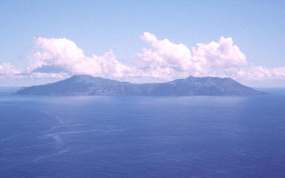
Geological Summary. The elongate, 9-km-long island of Anatahan in the central Mariana Islands consists of a large stratovolcano with a 2.3 x 5 km compound summit caldera. The larger western portion of the caldera is 2.3 x 3 km wide, and its western rim forms the island's high point. Ponded lava flows overlain by pyroclastic deposits fill the floor of the western caldera, whose SW side is cut by a fresh-looking smaller crater. The 2-km-wide eastern portion of the caldera contained a steep-walled inner crater whose floor prior to the 2003 eruption was only 68 m above sea level. A submarine cone, named NE Anatahan, rises to within 460 m of the sea surface on the NE flank, and numerous other submarine vents are found on the NE-to-SE flanks. Sparseness of vegetation on the most recent lava flows had indicated that they were of Holocene age, but the first historical eruption did not occur until May 2003, when a large explosive eruption took place forming a new crater inside the eastern caldera.
Information Contacts: N. Banks and J. Ewert, CVO; NEIC.

