Report on Apaneca Range (El Salvador) — September 1990
Bulletin of the Global Volcanism Network, vol. 15, no. 9 (September 1990)
Managing Editor: Lindsay McClelland.
Apaneca Range (El Salvador) Phreatic blast at hot springs; 14 people dead
Please cite this report as:
Global Volcanism Program, 1990. Report on Apaneca Range (El Salvador) (McClelland, L., ed.). Bulletin of the Global Volcanism Network, 15:9. Smithsonian Institution. https://doi.org/10.5479/si.GVP.BGVN199009-343010
Apaneca Range
El Salvador
13.872°N, 89.742°W; summit elev. 2028 m
All times are local (unless otherwise noted)
At approximately 0130 on 13 October a small phreatic blast occurred in the village of El Barro, in the SW portion of the Ahuachapán Geothermal Field. Agua Shuca (an area 2-3 m in diameter of fumaroles, mud pots, and altered ground at 13.90°N, 89.82°W) erupted violently, producing a "blast of wind, stones, and boiling water" that destroyed several small dwellings and affected an area with a 100-m radius. Fourteen people were reported killed and 21 injured [but see 15:11]. The explosion was reportedly directed and lasted about 20 seconds according to survivors. By 15 October, a quiet pond (below the boiling point), 10 m in diameter [but see 15:11], had formed in the explosion crater and the surrounding area was covered with mud.
The Ahuachapán geothermal field has been an extensively developed source of energy for more than 15 years. It is located in a highly fractured zone at the N base of Laguna Verde, an eroded stratovolcano with Pleistocene and possibly Holocene activity (figure 1). Agua Shuca is situated on a fault, 2 km S of the Ahuachapán power plant (figure 2), and is outside of the geothermal field drawdown area. A well drilled 100 m N of Agua Shuca in 1971 (AH-9), was not developed due to the low permeability of the rocks at the site. A large landslide in 1981, 1/2 km NE of Agua Shuca and along the same fault, occurred shortly after a test of the reservoir at the maximum rate of power extraction, stopped because of a dramatic pressure decline.
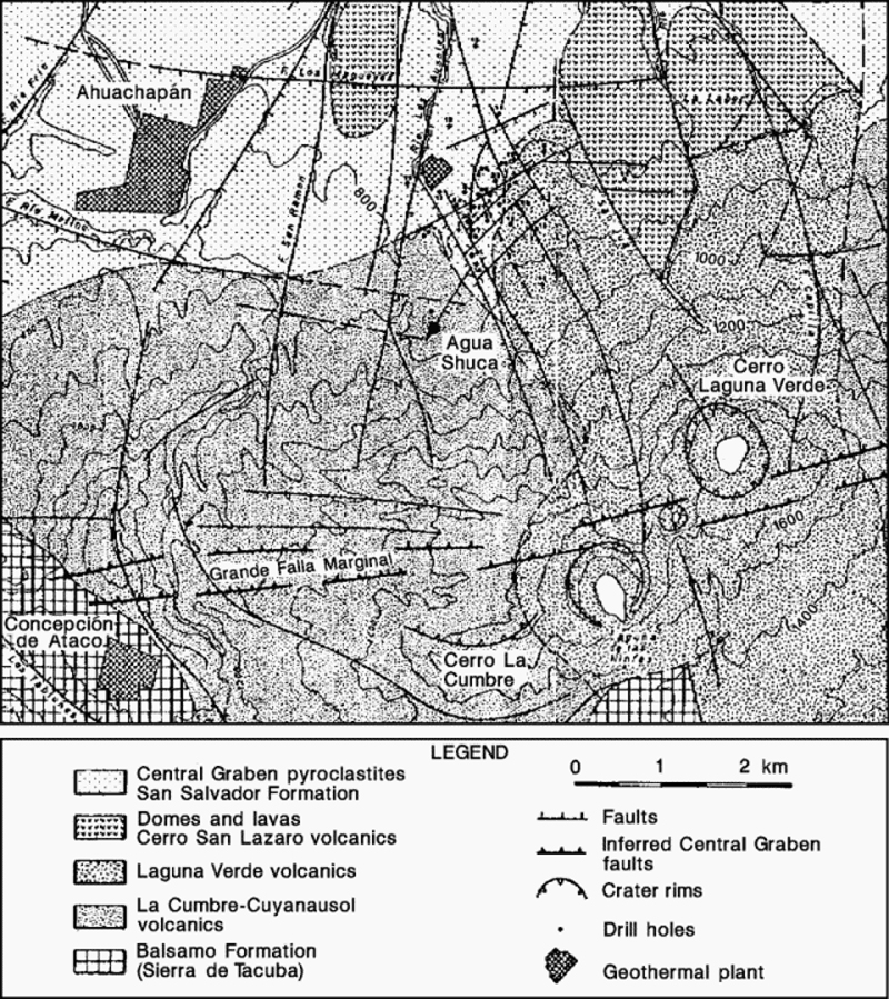 |
Figure 1. Portion of a geologic/structural map of Ahuachapán Geothermal Field and vicinity, prepared by the Comisión Executiva Hidroeléctrica del Río Lempa. Courtesy of Dina López. |
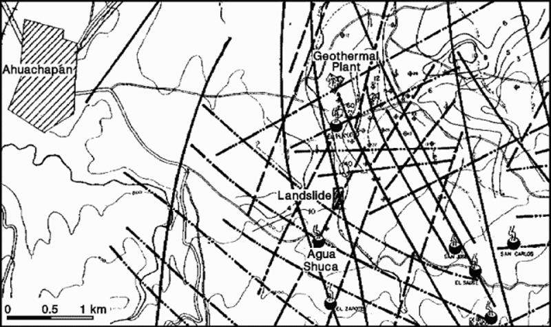 |
Figure 2. Detailed structural map of the Ahuachapán Geothermal Field, prepared by the Comisión Executiva Hidroeléctrica del Río Lempa. Heavy lines mark faults, large "steaming" circles indicate hot springs, and small circles with crosses show individual geothermal wells. Courtesy of Dina López. |
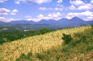
Geological Summary. The Apaneca Range (also known as the Cuyanausul Range) consists of a group of basaltic-to-andesitic Pleistocene and Holocene stratovolcanoes in western El Salvador between the Santa Ana complex and the Guatemala border. The Pleistocene dacitic-rhyolitic Concepción de Ataco caldera (5 x 3.5 km) lies at the W end of the complex, along with post-caldera late-Pleistocene to Holocene andesitic-dacitic lava domes. The post-caldera cones of Cerro el Aguila (the highest peak of the complex) and Cerro los Naranjos at the E end of the chain were mapped as Holocene by Weber and Weisemann (1978). Young craters on the basaltic Cerro Laguna Verde stratovolcano may also have been active during the Holocene. Numerous fumarole fields are located on the N flank of the range, and the Ahuachapán geothermal field has been producing since 1975. Several small hydrothermal explosions have occurred in historical time, including one in October 1990 at the Agua Shuca thermal area in which 26 people were killed.
Information Contacts: Rodolfo Caceres, División Geotermía, Comisión Executiva Hidroeléctrica del Río Lempa, Santa Tecla, La Libertad, El Salvador; Marshall Reed, US Dept of Energy; Marcelo Lippmann, Lawrence Berkeley Laboratory, Univ of California; Grant Heiken, Los Alamos National Laboratory; Dina López, Louisiana State Univ.