Report on Apaneca Range (El Salvador) — November 1990
Bulletin of the Global Volcanism Network, vol. 15, no. 11 (November 1990)
Managing Editor: Lindsay McClelland.
Apaneca Range (El Salvador) October explosion deaths rise to 26; new crater described
Please cite this report as:
Global Volcanism Program, 1990. Report on Apaneca Range (El Salvador) (McClelland, L., ed.). Bulletin of the Global Volcanism Network, 15:11. Smithsonian Institution. https://doi.org/10.5479/si.GVP.BGVN199011-343010
Apaneca Range
El Salvador
13.872°N, 89.742°W; summit elev. 2028 m
All times are local (unless otherwise noted)
The 13 October blast of steam and mud roared continuously (like a geyser) for 10-20 minutes, decreasing in intensity following the initial explosion (reported by a survivor to be around 20 seconds long). No seismic signals were recorded before or during the event by seismometers 4 and 30 km away. A portable seismometer, operated for a few days following the blast, also recorded no signals.
The 30-m-diameter, 15-m-deep crater produced by the blast was partially filled by a continuously boiling muddy lake during a 27 October visit. A sulfurous "rotten egg" smell was noted. Prior to the blast, the site was an area of steaming ground, with two small hot springs (1-2 m across) and 1 mudpot (1 m across) much smaller than the present crater.
The blast was laterally oblique to the N and its effects abruptly ended at a maximum of 130 m. Damage included downed trees and limbs, collapsed walls of buildings, and missing roofs. The massive, non-sorted deposits were clay-rich and composed of light-colored highly altered rock fragments. Deposits were thickest to the N where they ranged from 1 m on the crater rim to 30 cm at 20 m from the rim. The death toll increased to 26 after 13 people died in hospitals.
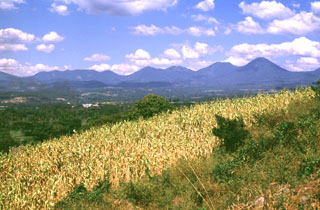
Geological Summary. The Apaneca Range (also known as the Cuyanausul Range) consists of a group of basaltic-to-andesitic Pleistocene and Holocene stratovolcanoes in western El Salvador between the Santa Ana complex and the Guatemala border. The Pleistocene dacitic-rhyolitic Concepción de Ataco caldera (5 x 3.5 km) lies at the W end of the complex, along with post-caldera late-Pleistocene to Holocene andesitic-dacitic lava domes. The post-caldera cones of Cerro el Aguila (the highest peak of the complex) and Cerro los Naranjos at the E end of the chain were mapped as Holocene by Weber and Weisemann (1978). Young craters on the basaltic Cerro Laguna Verde stratovolcano may also have been active during the Holocene. Numerous fumarole fields are located on the N flank of the range, and the Ahuachapán geothermal field has been producing since 1975. Several small hydrothermal explosions have occurred in historical time, including one in October 1990 at the Agua Shuca thermal area in which 26 people were killed.
Information Contacts: C. Dan Miller, USGS.