Report on Alcedo (Ecuador) — April 1991
Bulletin of the Global Volcanism Network, vol. 16, no. 4 (April 1991)
Managing Editor: Lindsay McClelland.
Alcedo (Ecuador) Sonic activity and felt earthquakes decline; minor changes to hydrothermal system
Please cite this report as:
Global Volcanism Program, 1991. Report on Alcedo (Ecuador) (McClelland, L., ed.). Bulletin of the Global Volcanism Network, 16:4. Smithsonian Institution. https://doi.org/10.5479/si.GVP.BGVN199104-353040
Alcedo
Ecuador
0.43°S, 91.12°W; summit elev. 1130 m
All times are local (unless otherwise noted)
Late-April fieldwork revealed continued but diminished sonic activity, no evidence of an eruption, and only minor changes to the volcano's hydrothermal system.
Biologist Milton Friere, working on the island since February, reported that he felt a strong shock, apparently on 9 March at about 1900. Hunters on Santiago Island, 35 km NE of Alcedo, also felt a large earthquake around that time but there is uncertainty about the date and the WWSSN recorded only the 3 March event (16:3). Immediately after the felt earthquake, explosion sounds began to be heard daily at Friere's camp on the caldera's N rim. The initial sounds were the most intense and frequent, then they declined gradually, and by late April were heard only once every few days from the N rim camp. Fewer than 5 earthquakes were felt at the camp until 5 April. Others were documented on 5 April at 1740, 7 April at 1700, and 17 April at 1725. Events of similar intensity may have gone unnoticed during active fieldwork.
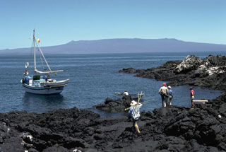
While camped on the caldera's S rim during a 23-28 April field survey, Dennis Geist heard eight explosion sounds in 3 days, compared to 2-13 heard daily by Tui DeRoy and Mark Jones in late March (16:3). All were heard in camp, with none noticed during fieldwork. The sounds, consisting of deep rumbling lasting about a second, were likened to thunder generated ~ 10 km away. Although the sounds were clearly directional, each seemed to come from a different direction. None were accompanied by discernible changes in fumarole output, but two were followed 10-15 seconds later by a felt earthquake. The stronger earthquake lasted 5-10 seconds, whereas the weaker one continued for more than 30 seconds after a strong initial jolt.
The seismicity and sonic activity were preceded by the first heavy rains in the Galápagos for several years. Between 26 February and 4 March, 5-10 cm of rain fell daily on Alcedo. Heavy rains also fell on 6, 8, 10, 19, and 30 March, and 10 and 15 April.
Geist noted only subtle changes to the hydrothermal system. Before the 1991 activity, hundreds of fumaroles were distributed around both the southern ring faults and a vent that erupted voluminous rhyolitic pumice and obsidian flows about 90,000 years ago. Fewer than 10 small new fumaroles (identified by remains of recently killed plants) were observed, and no significant increase in total gas output was evident. A large fumarole (called "the Geyser" because it formerly ejected water) may have been somewhat more vigorous than during Geist's previous visits in 1989 and 1983. The vapor plume from this fumarole varied dramatically over periods of hours, and at times there was no visible cloud. No recently formed fissures or fault scarps were observed.
Geological Summary. Alcedo is one of the lowest and smallest of six shield volcanoes on Isabela Island. Much of the flanks and summit caldera are vegetated, but young lava flows are prominent on the N flank near the saddle with Darwin volcano. It is the only Galapagos volcano known to have erupted rhyolite as well as basalt, producing about 1 km3 of late-Pleistocene rhyolitic tephra and lava flows from several vents late in its history. Recent faulting has produced a moat around part of the 7-8 km caldera floor, which is elongated N-S and appears to be migrating to the south. Fewer circumferential fissures occur on Alcedo than on other western Galápagos volcanoes. An eruption attributed to Alcedo in 1954 (Richards, 1957) is more likely to have been from neighboring Sierra Negra (Simkin 1980, pers. comm.). Photo-geologic mapping by K.A. Howard (pers. comm.) revealed only one flow on 30 October 1960 photographs that does not appear on 30 May 1946 photos. That is near Cartago Bay, low on the SE flank, rather than the 610-m, NE-flank elevation listed for the 1954 eruption. An active hydrothermal system is located within the caldera.
Information Contacts: D. Geist, Univ of Idaho.