Report on Klyuchevskoy (Russia) — June 1991
Bulletin of the Global Volcanism Network, vol. 16, no. 6 (June 1991)
Managing Editor: Lindsay McClelland.
Klyuchevskoy (Russia) Small plume seen from satellite image
Please cite this report as:
Global Volcanism Program, 1991. Report on Klyuchevskoy (Russia) (McClelland, L., ed.). Bulletin of the Global Volcanism Network, 16:6. Smithsonian Institution. https://doi.org/10.5479/si.GVP.BGVN199106-300260
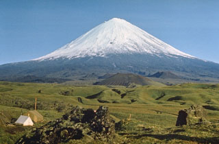
Klyuchevskoy
Russia
56.056°N, 160.642°E; summit elev. 4754 m
All times are local (unless otherwise noted)
The NOAA 10 polar-orbiting weather satellite showed a plume ~20 km long, extending S from the summit then turning SW, on 24 June at 1024.
Geological Summary. Klyuchevskoy is the highest and most active volcano on the Kamchatka Peninsula. Since its origin about 6,000 years ago, this symmetrical, basaltic stratovolcano has produced frequent moderate-volume explosive and effusive eruptions without major periods of inactivity. It rises above a saddle NE of Kamen volcano and lies SE of the broad Ushkovsky massif. More than 100 flank eruptions have occurred during approximately the past 3,000 years, with most lateral craters and cones occurring along radial fissures between the unconfined NE-to-SE flanks of the conical volcano between 500 and 3,600 m elevation. Eruptions recorded since the late 17th century have resulted in frequent changes to the morphology of the 700-m-wide summit crater. These eruptions over the past 400 years have originated primarily from the summit crater, but have also included numerous major explosive and effusive eruptions from flank craters.
Information Contacts: W. Gould, NOAA/NESDIS.