Report on Nyamulagira (DR Congo) — September 1991
Bulletin of the Global Volcanism Network, vol. 16, no. 9 (September 1991)
Managing Editor: Lindsay McClelland.
Nyamulagira (DR Congo) Lava flows and plumes reported
Please cite this report as:
Global Volcanism Program, 1991. Report on Nyamulagira (DR Congo) (McClelland, L., ed.). Bulletin of the Global Volcanism Network, 16:9. Smithsonian Institution. https://doi.org/10.5479/si.GVP.BGVN199109-223020
Nyamulagira
DR Congo
1.408°S, 29.2°E; summit elev. 3058 m
All times are local (unless otherwise noted)
An eruption . . . apparently began on 20 or 22 September . . . . On 24 September, the Nimbus-7 satellite's TOMS showed an SO2 enhancement, just above detection limits, centered immediately over the volcano. A small amount of SO2 may have been present the previous day, but increased SO2 was not evident 20-22 or 25 September. No additional reports of activity were received until the crew of a British Airways flight observed an eruption cloud rising to ~7.5 km altitude on 15 October at 0555. In a report received 18 October, observers in Goma, Zaire (roughly 30 km S of the summit) described lava flows to the NW and SE [but see 17:1] and an eruption cloud rising to ~3.5 km from a site at 1.28°S, 29.22°E (on the NNE flank) [see slightly revised coordinates in 17:1]. South African Airways reported a plume to ~7.5 km altitude, probably on 20 October.
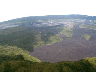
Geological Summary. Africa's most active volcano, Nyamulagira (also known as Nyamuragira), is a massive high-potassium basaltic shield about 25 km N of Lake Kivu and 13 km NNW of the steep-sided Nyiragongo volcano. The summit is truncated by a small 2 x 2.3 km caldera that has walls up to about 100 m high. Documented eruptions have occurred within the summit caldera, as well as from the numerous flank fissures and cinder cones. A lava lake in the summit crater, active since at least 1921, drained in 1938, at the time of a major flank eruption. Recent lava flows extend down the flanks more than 30 km from the summit as far as Lake Kivu; extensive lava flows from this volcano have covered 1,500 km2 of the western branch of the East African Rift.
Information Contacts: ICAO; S. Doiron, GSFC; H-L. Hody, GEOVAR, Kigali, Rwanda.

