Report on Marchena (Ecuador) — September 1991
Bulletin of the Global Volcanism Network, vol. 16, no. 9 (September 1991)
Managing Editor: Lindsay McClelland.
Marchena (Ecuador) Lava from circumferential fissure flows into caldera and ocean
Please cite this report as:
Global Volcanism Program, 1991. Report on Marchena (Ecuador) (McClelland, L., ed.). Bulletin of the Global Volcanism Network, 16:9. Smithsonian Institution. https://doi.org/10.5479/si.GVP.BGVN199109-353080
Marchena
Ecuador
0.33°N, 90.47°W; summit elev. 343 m
All times are local (unless otherwise noted)
The eruption was first observed on 25 September at about 2100 from a ship ~ 75 km S of Marchena [but see 16:10], and glow remained visible through the night. A large black and white eruption cloud was reported the next day, but no glow was evident during cloudy weather that night from a nearby island. During an overflight around midday on 27 September, a dark plume was visible above low weather clouds.
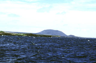
When David Day and others arrived at the island's W coast on 28 September at about 2230, lava was flowing into the sea along a front ~1.5 km wide. Incandescence was evident at about 10 sites over a roughly 3 x 3 km area, but lava fountaining had apparently stopped. The next day, small quantities of Pele's hair were found on the beach near the fresh flows, along with substantial numbers of dead fish and other marine organisms. Scuba divers found glassy breccia near the shore, a zone of aa rubble extending seaward for several hundred meters, and, with gradual increase in slope from 25 to 35 m depth, a small lava flow that included pillow structures. A 30 September summit climb revealed new lava covering much of the caldera's SW floor, suggesting that a circumferential fissure several kilometers long had been active on the W to SW rim, supplying lava to both the caldera floor and the outer flank.
Geological Summary. The low shield volcano forming Marchena Island contains one of the largest calderas of the Galápagos Islands. The 6 x 7 km caldera and its outer flanks have been largely buried by a cluster of pyroclastic cones and associated lava flows. Its first historical eruption occurred in 1991. Other young lava flows, some of which may be only a few thousand, or even a few hundred years old, filled the caldera and flowed down its outer forested flanks, in some cases to the sea.
Information Contacts: D. Day, Isla Santa Cruz.