Report on Lokon-Empung (Indonesia) — October 1991
Bulletin of the Global Volcanism Network, vol. 16, no. 10 (October 1991)
Managing Editor: Lindsay McClelland.
Lokon-Empung (Indonesia) Vigorous explosions; 10,000 evacuated
Please cite this report as:
Global Volcanism Program, 1991. Report on Lokon-Empung (Indonesia) (McClelland, L., ed.). Bulletin of the Global Volcanism Network, 16:10. Smithsonian Institution. https://doi.org/10.5479/si.GVP.BGVN199110-266100
Lokon-Empung
Indonesia
1.3644°N, 124.7992°E; summit elev. 1580 m
All times are local (unless otherwise noted)
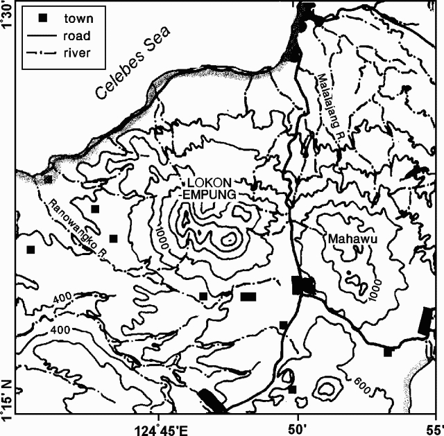
Vigorous explosions on 24 October ejected ash to ~2 km height, and may have generated a pyroclastic flow on 25 October, before a decline in activity noted at 2000. As much as 1 m of tephra was reportedly deposited near the summit, but only 2.5 cm of ash fell 4 km E (at Kinilaw). The airport at Manado (15 km NE; figure 1) was closed until 29 October, because of poor visibility and minor ashfall. By 29 October, more than 1900 buildings and roughly 3 km2 of clove trees and coconut palms had been damaged; ~10,000 people were evacuated. Ash and incandescent material ejected on 6 November reached 300 m height. Large explosions on 17 and 20 November produced ash columns 1,000 and 2,500 m high, respectively, panicking residents of nearby villages, who had recently returned to their homes. Ash emissions continued the next day, but were less frequent and less intense. Vivianne Clavel, a Swiss volcanologist studying the eruption, was reported missing on 24 October, and had not been located by searchparties at press time.
[Despite rescue efforts, no signs of V. Clavel were found. According to a witness, she was killed by falling blocks and buried by ash.]
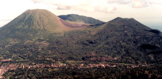
Geological Summary. The Lokong-Empung volcanic complex, rising above the plain of Tondano in North Sulawesi, includes four peaks and an active crater. Lokon, the highest peak, has a flat craterless top. The morphologically younger Empung cone 2 km NE has a 400-m-wide, 150-m-deep crater that erupted last in the 18th century. A ridge extending 3 km WNW from Lokon includes the Tatawiran and Tetempangan peaks. All eruptions since 1829 have originated from Tompaluan, a 150 x 250 m crater in the saddle between Lokon and Empung. These eruptions have primarily produced small-to-moderate ash plumes that sometimes damaged croplands and houses, but lava-dome growth and pyroclastic flows have also occurred.
Information Contacts: N. MacLeod, Ridgefield WA, USA; T. Casadevall, USGS; U.S. Embassy, Jakarta; UPI; Reuters; AP.


