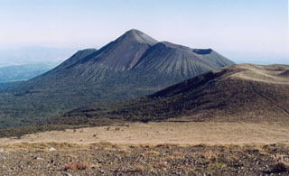
Report on Kirishimayama (Japan) — January 1992
Bulletin of the Global Volcanism Network, vol. 17, no. 1 (January 1992)
Managing Editor: Lindsay McClelland.
Kirishimayama (Japan) Slight ash emission; seismicity declines
Please cite this report as:
Global Volcanism Program, 1992. Report on Kirishimayama (Japan) (McClelland, L., ed.). Bulletin of the Global Volcanism Network, 17:1. Smithsonian Institution. https://doi.org/10.5479/si.GVP.BGVN199201-282090
Kirishimayama
Japan
31.934°N, 130.862°E; summit elev. 1700 m
All times are local (unless otherwise noted)
Steam emission . . . continued in January reaching 200-400 m height. Fieldwork 28-29 January revealed a trace of ash covering half of the crater floor, but no associated changes in seismicity were recorded. The monthly number of earthquakes declined to 38 in January, from 86 in December. Weak tremor was recorded continuously by seismometers near the cone, from late November through early February.
Geological Summary. Kirishimayama is a large group of more than 20 Quaternary volcanoes located north of Kagoshima Bay. The late-Pleistocene to Holocene dominantly andesitic group consists of stratovolcanoes, pyroclastic cones, maars, and underlying shield volcanoes located over an area of 20 x 30 km. The larger stratovolcanoes are scattered throughout the field, with the centrally located Karakunidake being the highest. Onamiike and Miike, the two largest maars, are located SW of Karakunidake and at its far eastern end, respectively. Holocene eruptions have been concentrated along an E-W line of vents from Miike to Ohachi, and at Shinmoedake to the NE. Frequent small-to-moderate explosive eruptions have been recorded since the 8th century.
Information Contacts: JMA.

