Report on Spurr (United States) — October 1992
Bulletin of the Global Volcanism Network, vol. 17, no. 10 (October 1992)
Managing Editor: Lindsay McClelland.
Spurr (United States) Seismicity but no eruption
Please cite this report as:
Global Volcanism Program, 1992. Report on Spurr (United States) (McClelland, L., ed.). Bulletin of the Global Volcanism Network, 17:10. Smithsonian Institution. https://doi.org/10.5479/si.GVP.BGVN199210-313040
Spurr
United States
61.299°N, 152.251°W; summit elev. 3374 m
All times are local (unless otherwise noted)
Seismicity has continued at Spurr following the explosive activity of 16-17 September. Minor low-amplitude tremor stopped 24 October, but several earthquakes were typically recorded daily, with depths ranging from shallow to nearly 50 km. A swarm of shallow seismic events began at about 0200 on 9 November and strengthened through the day. The alert level was raised (to orange, then red) by AVO, but the swarm subsided the next day without an eruption. An overflight on the 10th revealed no evidence of activity or morphologic changes in the vicinity of the crater. Earthquakes continued to occur beneath Spurr at rates of several per day through mid-November.
Gas emission rates remained low. The gas plume was particularly visible on 29 October because of clear, cool weather. A landslide occurred on the SE side of Crater Peak, sometime after a morning snowfall on 28 October but before the 29 October overflight. The landslide formed a 30-m-wide scar near 2,000 m altitude and carried debris to ~1,000 m elevation.
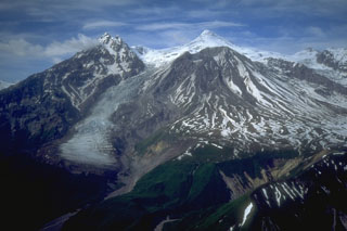
Geological Summary. Mount Spurr is the closest volcano to Anchorage, Alaska (130 km W) and just NE of Chakachamna Lake. The summit is a large lava dome at the center of a roughly 5-km-wide amphitheater open to the south formed by a late-Pleistocene or early Holocene debris avalanche and associated pyroclastic flows that destroyed an older edifice. The debris avalanche traveled more than 25 km SE, and the resulting deposit contains blocks as large as 100 m in diameter. Several ice-carved post-collapse cones or lava domes are present. The youngest vent, Crater Peak, formed at the southern end of the amphitheater and has been the source of about 40 identified Holocene tephra layers. Eruptions from Crater Peak in 1953 and 1992 deposited ash in Anchorage.
Information Contacts: AVO.

