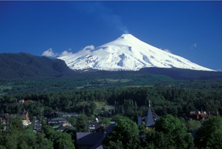
Report on Villarrica (Chile) — October 1992
Bulletin of the Global Volcanism Network, vol. 17, no. 10 (October 1992)
Managing Editor: Lindsay McClelland.
Villarrica (Chile) Ash eruption builds two new cones
Please cite this report as:
Global Volcanism Program, 1992. Report on Villarrica (Chile) (McClelland, L., ed.). Bulletin of the Global Volcanism Network, 17:10. Smithsonian Institution. https://doi.org/10.5479/si.GVP.BGVN199210-357120
Villarrica
Chile
39.42°S, 71.93°W; summit elev. 2847 m
All times are local (unless otherwise noted)
Explosions began on 3 November at 1640. Sebastián Moraga, a forest guard at Villarrica National Park, felt ~ 240 explosions in the next 3 hours. At 1940, a vigorous explosion ejected ash, which fell on a 200 x 250-m area on the NW flank. At the same time, the telemetering seismic station (operated by the Univ de la Frontera) 4.5 km from the crater recorded a strong increase in seismicity. The next day at 1326, a new explosion was felt by the forest guard. A plume drifted toward the SW that afternoon.
Tourists reported two new small pyroclastic cones on 6 November. The cones exhibited intense explosive activity and underground noises. Ash deposits were visible on NW-flank snow on 9 November. Clouds obscured the volcano on 10 November, but a portable seismograph (in Lican Ray) and a flank telemetric station recorded an increase in tremor amplitude and frequency.
Geological Summary. The glacier-covered Villarrica stratovolcano, in the northern Lakes District of central Chile, is ~15 km south of the city of Pucon. A 2-km-wide caldera that formed about 3,500 years ago is located at the base of the presently active, dominantly basaltic to basaltic andesite cone at the NW margin of a 6-km-wide Pleistocene caldera. More than 30 scoria cones and fissure vents are present on the flanks. Plinian eruptions and pyroclastic flows that have extended up to 20 km from the volcano were produced during the Holocene. Lava flows up to 18 km long have issued from summit and flank vents. Eruptions documented since 1558 CE have consisted largely of mild-to-moderate explosive activity with occasional lava effusion. Glaciers cover 40 km2 of the volcano, and lahars have damaged towns on its flanks.
Information Contacts: G. Fuentealba and M. Petit-Breuilh, S.A.V.O. Seismological Team, Univ de la Frontera, Fundacion Andes, Temuco.

