Report on Tangkuban Parahu (Indonesia) — November 1992
Bulletin of the Global Volcanism Network, vol. 17, no. 11 (November 1992)
Managing Editor: Lindsay McClelland.
Tangkuban Parahu (Indonesia) Increased seismicity but no surface changes evident
Please cite this report as:
Global Volcanism Program, 1992. Report on Tangkuban Parahu (Indonesia) (McClelland, L., ed.). Bulletin of the Global Volcanism Network, 17:11. Smithsonian Institution. https://doi.org/10.5479/si.GVP.BGVN199211-263090
Tangkuban Parahu
Indonesia
6.77°S, 107.6°E; summit elev. 2084 m
All times are local (unless otherwise noted)
Seismicity began to increase on 28 September. B-type earthquakes were continuing in early December, at rates of 47-204/week. None of the vents on the crater floor showed signs of unusual activity. Visitors are still advised to avoid descending to the bottom of the crater.
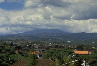
Geological Summary. Gunung Tangkuban Parahu is a broad stratovolcano overlooking Indonesia's former capital city of Bandung. The volcano was constructed within the 6 x 8 km Pleistocene Sunda caldera, which formed about 190,000 years ago. The volcano's low profile is the subject of legends referring to the mountain of the "upturned boat." The Sunda caldera rim forms a prominent ridge on the western side; elsewhere the rim is largely buried by deposits of the current volcano. The dominantly small phreatic eruptions recorded since the 19th century have originated from several nested craters within an elliptical 1 x 1.5 km summit depression.
Information Contacts: W. Modjo, VSI.