Report on Spurr (United States) — December 1992
Bulletin of the Global Volcanism Network, vol. 17, no. 12 (December 1992)
Managing Editor: Lindsay McClelland.
Spurr (United States) Continued seismicity
Please cite this report as:
Global Volcanism Program, 1992. Report on Spurr (United States) (McClelland, L., ed.). Bulletin of the Global Volcanism Network, 17:12. Smithsonian Institution. https://doi.org/10.5479/si.GVP.BGVN199212-313040
Spurr
United States
61.299°N, 152.251°W; summit elev. 3374 m
All times are local (unless otherwise noted)
No eruptive episodes have occurred at Spurr since 16-17 September (BGVN 17:08). Seismicity continued through early January beneath the S flank's Crater Peak, source of the 1992 eruptions.
A series of earthquakes was recorded during the night of 14 December, and a fresh landslide scar was seen on the NW side of the crater the next day. Two hours of tremor on 17 December may have been related to rockfall activity. A swarm of small earthquakes at 8-12 km depth 21-26 December was followed by a pair of hour-long shallow tremor-like episodes on 27 December. Activity then declined, but two more periods of low-amplitude tremor, each lasting more than an hour, were recorded by a station on the rim of Crater Peak on 30 December. Shallow seismic activity remained above background in mid-January.
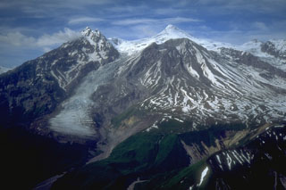
Geological Summary. Mount Spurr is the closest volcano to Anchorage, Alaska (130 km W) and just NE of Chakachamna Lake. The summit is a large lava dome at the center of a roughly 5-km-wide amphitheater open to the south formed by a late-Pleistocene or early Holocene debris avalanche and associated pyroclastic flows that destroyed an older edifice. The debris avalanche traveled more than 25 km SE, and the resulting deposit contains blocks as large as 100 m in diameter. Several ice-carved post-collapse cones or lava domes are present. The youngest vent, Crater Peak, formed at the southern end of the amphitheater and has been the source of about 40 identified Holocene tephra layers. Eruptions from Crater Peak in 1953 and 1992 deposited ash in Anchorage.
Information Contacts: AVO.

