Report on Tolbachik (Russia) — January 1994
Bulletin of the Global Volcanism Network, vol. 19, no. 1 (January 1994)
Managing Editor: Richard Wunderman.
Tolbachik (Russia) Seismic monitoring stations installed; activity at background levels
Please cite this report as:
Global Volcanism Program, 1994. Report on Tolbachik (Russia) (Wunderman, R., ed.). Bulletin of the Global Volcanism Network, 19:1. Smithsonian Institution. https://doi.org/10.5479/si.GVP.BGVN199401-300240
Tolbachik
Russia
55.832°N, 160.326°E; summit elev. 3611 m
All times are local (unless otherwise noted)
Seismic monitoring . . . by the KVERT began in late January 1994 when two stations were installed. Since then seismicity was considered to be at background levels. One earthquake was registered on 25 January. During the period from 28 January to 2 February, shallow volcanic earthquakes were registered at a rate of 5-13/day. The following week (3-8 February) there were 1-4 shallow earthquakes recorded each day.
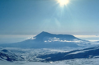
Geological Summary. The massive Tolbachik volcano is located at the southern end of the Kliuchevskaya volcano group. The massif is composed of two overlapping, but morphologically distinct, volcanoes. The flat-topped Plosky Tolbachik shield volcano with its nested Holocene calderas up to 3 km in diameter is located east of the older and higher sharp-topped Ostry Tolbachik stratovolcano. The summit caldera at Plosky Tolbachik was formed in association with major lava effusion about 6,500 years ago and simultaneously with a major southward-directed sector collapse of Ostry Tolbachik. Long rift zones extending NE and SSW of the volcano have erupted voluminous basaltic lava flows during the Holocene, with activity during the past two thousand years being confined to the narrow axial zone of the rifts. The 1975-76 eruption originating from the SSW-flank fissure system and the summit was the largest historical basaltic eruption in Kamchatka.
Information Contacts: V. Kirianov, IVGG.