Report on Deception Island (Antarctica) — September 1994
Bulletin of the Global Volcanism Network, vol. 19, no. 9 (September 1994)
Managing Editor: Edward Venzke.
Deception Island (Antarctica) Seismicity decreases; fumarole temperatures stable
Please cite this report as:
Global Volcanism Program, 1994. Report on Deception Island (Antarctica) (Venzke, E., ed.). Bulletin of the Global Volcanism Network, 19:9. Smithsonian Institution. https://doi.org/10.5479/si.GVP.BGVN199409-390030
Deception Island
Antarctica
62.9567°S, 60.6367°W; summit elev. 602 m
All times are local (unless otherwise noted)
The Deception Volcano Observatory (figure 9) was created in 1993, but the volcano has been monitored every summer since 1986. Seismicity remained stable during the austral summer of 1993-94. The decrease in seismic activity seen during 1992-93 from 1991-92 levels continued. Only a few small local seismic events (M 1.5-2) and some larger events (M 2.5, >100 km depth) were detected. Fumaroles emitted mainly CO2 (94.7%) and H2S (3.5%); no SO2 was detected. Fumarole temperatures were similar to previous years near the Argentine Station (60.5°C), in Fumarole Bay (101.2°C), and at Steaming Hill (98.5°C).
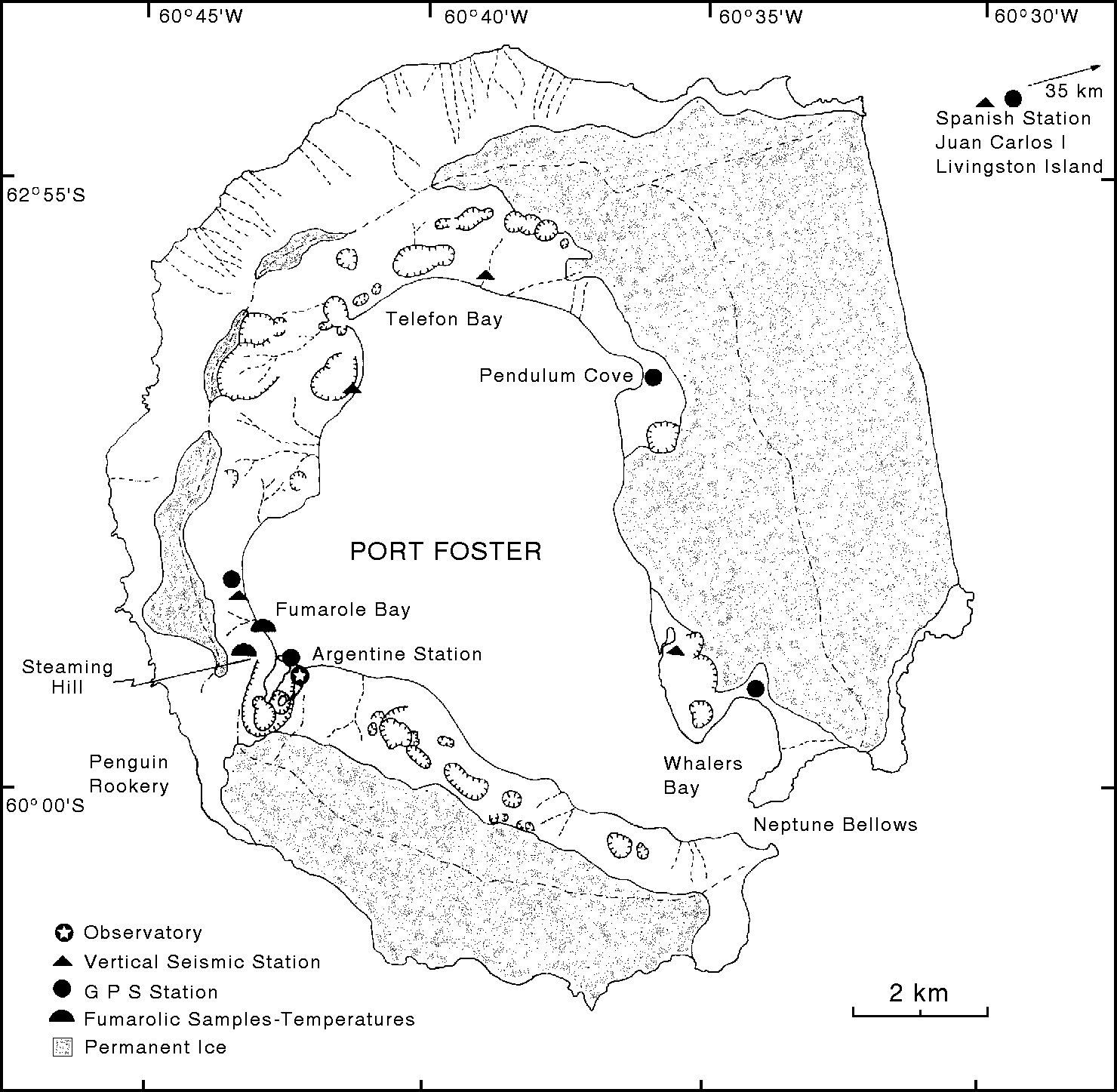 |
Figure 9. Map of Deception Island during 1993-94 showing craters, ice cover, the volcano observatory, and locations of monitoring equipment. Equipment near the observatory includes an electronic clinometer, a gravimeter, a magnetometer, and a 3-component seismic station. Courtesy of the Instituto Antártico Argentino. |
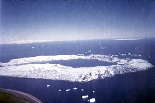
Geological Summary. Ring-shaped Deception Island, at the SW end of the South Shetland Islands, NE of Graham Land Peninsula, was constructed along the axis of the Bransfield Rift spreading center. A narrow passageway named Neptunes Bellows provides an entrance to a natural harbor within the 8.5 x 10 km caldera that was utilized as an Antarctic whaling station. Numerous vents along ring fractures circling the low 14-km-wide island have been reported active for more than 200 years. Maars line the shores of 190-m-deep Port Foster caldera bay. Among the largest of these maars is 1-km-wide Whalers Bay, at the entrance to the harbor. Eruptions during the past 8,700 years have been dated from ash layers in lake sediments on the Antarctic Peninsula and neighboring islands.
Information Contacts: C. Risso, Instituto Antártico Argentino; R. Ortiz, Museo Nacional de Ciencias Naturales, Spain.