Report on Cerro Negro (Nicaragua) — April 1996
Bulletin of the Global Volcanism Network, vol. 21, no. 4 (April 1996)
Managing Editor: Richard Wunderman.
Cerro Negro (Nicaragua) Gentle degassing and lava-flow fumaroles; 1995 cone partially collapsed
Please cite this report as:
Global Volcanism Program, 1996. Report on Cerro Negro (Nicaragua) (Wunderman, R., ed.). Bulletin of the Global Volcanism Network, 21:4. Smithsonian Institution. https://doi.org/10.5479/si.GVP.BGVN199604-344070
Cerro Negro
Nicaragua
12.506°N, 86.702°W; summit elev. 728 m
All times are local (unless otherwise noted)
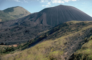
Cerro Negro was visited 11-13 March by a joint team from the Open University, the Universite de Montreal, Reading University, and INETER. The main vent was degassing gently, the plume was barely visible, and no ash was observed within the column. The 1995 cinder cone (BGVN 20:11/12) had radial fissures on the W crater rim that were surrounded by fresh sulfur deposits. The E side of the 1995 cinder cone was unstable and had partly collapsed. A topographic survey of the new cinder cone showed that the summit elevation is 708 m above sea level. Volcanic bombs from the 1995 eruption were observed at the base of the main cone, varying in composition from basaltic scoria to pure sulfur. Fumaroles at the proximal end of the 1995 lava flow were clearly marked by surrounding sublimation halos. A topographic survey of the 1995 flow field will be used to calculate its volume and morphology.
Geological Summary. Nicaragua's youngest volcano, Cerro Negro, was created following an eruption that began in April 1850 about 2 km NW of the summit of Las Pilas volcano. It is the largest, southernmost, and most recent of a group of four youthful cinder cones constructed along a NNW-SSE-trending line in the central Marrabios Range. Strombolian-to-subplinian eruptions at intervals of a few years to several decades have constructed a roughly 250-m-high basaltic cone and an associated lava field constrained by topography to extend primarily NE and SW. Cone and crater morphology have varied significantly during its short eruptive history. Although it lies in a relatively unpopulated area, occasional heavy ashfalls have damaged crops and buildings.
Information Contacts: Hazel Rymer and Mark Davies, Department of Earth Sciences, The Open University, Milton Keynes MK7 6AA, United Kingdom; John Stix, Dora Knez, Glyn Williams-Jones, and Alexandre Beaulieu, Departement de Geologie, Universite de Montreal, Montreal, Quebec H3C 3J7, Canada; Nicki Stevens, Department of Geography, University of Reading, Reading RG2 2AB, United Kingdom; Martha Navarro and Pedro Perez, INETER, Apartado Postal 2110, Managua, Nicaragua.