Report on Pacaya (Guatemala) — December 1996
Bulletin of the Global Volcanism Network, vol. 21, no. 12 (December 1996)
Managing Editor: Richard Wunderman.
Pacaya (Guatemala) Strombolian eruptions and lava flows from MacKenney crater
Please cite this report as:
Global Volcanism Program, 1996. Report on Pacaya (Guatemala) (Wunderman, R., ed.). Bulletin of the Global Volcanism Network, 21:12. Smithsonian Institution. https://doi.org/10.5479/si.GVP.BGVN199612-342110
Pacaya
Guatemala
14.382°N, 90.601°W; summit elev. 2569 m
All times are local (unless otherwise noted)
Reports by Otoniel Matías of INSIVUMEH described volcanic activity after the 11 November eruption (BGVN 21:11) until 12 December. Seismic data were registered at a local one-component station (exact location undisclosed).
Activity during 11-30 November 1996. Heightened explosive Strombolian activity from MacKenney crater on 11 November was accompanied by abundant lava flows that covered most of the SW flank and traveled as far as 2 km from the volcano. The ash column reached 2 km, and deposited a 7-cm-thick layer of coarse tephra (1-3 cm in size) over the village of El Caracol (~4 km SW of the summit). Ash transported SW by strong winds fell in Escuintla and, as some local newspapers reported, in the Mexican city of Tapachula (300 km NW). At 2010 of the same day the eruption started dying down.
For the remainder of the month there was continuous emission of white-blue "smoke" at variable heights (50-300 m) above the crater. After the 11 November eruption seismicity was dominated by type-A volcano-tectonic swarms. During the next few days the swarm's foci deepened from 0.2-1 km to 5-10 km and then to 15-20 km and finally on 18 November, to 25-35 km. On 12 November a lava tongue ~2.5 km long was flowing S toward Cerro Buena Vista. On 13 November another small lava flow ~450 m long was observed on the SW flank.
During 15-18 November there were explosions of variable intensity every 1-3 minutes; the strongest explosions lasted 25-50 seconds and had amplitudes of 35-40 mm (peak-to-peak) and frequencies of 3-5 Hz. These explosions expelled pyroclastic material 75-150 m above the crater, depositing most material inside the crater.
On 20 November the seismic activity became characterized by harmonic tremor and type-B earthquakes, indicating magma movement toward the crater. The same day an eyewitness reported a red glow inside the main crater. Early on 21 November the white-blue column rose >500 m above MacKenney crater, but later that day decreased to ~300 m.
During 26-28 November the seismicity became characterized by alternating periods of activity followed by quiet for about 12 hours. The seismic activity shifted between seismo-tectonic swarms (one event every 2-10 minutes) and continuous tremor, suggesting that magma was ascending from depth and the confining rock was adjusting to the new stress field. After 28 November the activity was again dominated by seismo-tectonic events. Originating at depths of 0.2-1 km and up to M 1, there were 467 such events during a 24-hour observation period.
Activity during 1-12 December 1996. The white-blue column observed during November was also reported throughout this period at heights of 70-250 m. On 2, 3, and 4 December small explosions every 1-8 minutes were accompanied by ejection of incandescent material up to 100 m above MacKenney crater. This Strombolian activity was associated with harmonic tremor, although such tremors had appeared since the night of 1 December.
On 5 December puffs of steam lasting 5-7 minutes built up a column that rose 400 m. On 6 December, steam-and-ash expulsions of variable intensity turned brown in color and were observed at intervals of 2-10 minutes.
During 7-10 December the seismicity was characterized by tremor (mean amplitude, 2-5 mm; frequency, 3-4 Hz; and duration, 2-15 minutes) and type-A seismic events at 0.3-1 km depth. On 10-11 December steaming was observed on the N, W, and SW flanks of the MacKenney cone.
On 12 December white-blue emissions reached 300 m above the crater and drifted slowly SW for 5 km. That day, low-amplitude, low-frequency (0.5-1 Hz) harmonic tremor alternated with pulses of disharmonious tremor with amplitude 3-10 mm and 4-6 Hz frequency. During these pulses, steam-and-ash emissions occurred in association with considerable mass wasting inside the crater.
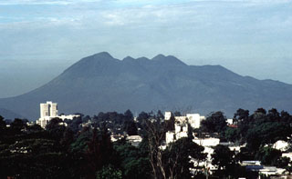
Geological Summary. Eruptions from Pacaya are frequently visible from Guatemala City, the nation's capital. This complex basaltic volcano was constructed just outside the southern topographic rim of the 14 x 16 km Pleistocene Amatitlán caldera. A cluster of dacitic lava domes occupies the southern caldera floor. The post-caldera Pacaya massif includes the older Pacaya Viejo and Cerro Grande stratovolcanoes and the currently active Mackenney stratovolcano. Collapse of Pacaya Viejo between 600 and 1,500 years ago produced a debris-avalanche deposit that extends 25 km onto the Pacific coastal plain and left an arcuate scarp inside which the modern Pacaya volcano (Mackenney cone) grew. The NW-flank Cerro Chino crater was last active in the 19th century. During the past several decades, activity has consisted of frequent Strombolian eruptions with intermittent lava flow extrusion that has partially filled in the caldera moat and covered the flanks of Mackenney cone, punctuated by occasional larger explosive eruptions that partially destroy the summit.
Information Contacts: Otoniel Matías, Seccion Vulcanologia, INSIVUMEH (Instituto Nacional de Sismologia, Vulcanologia, Meteorologia e Hydrologia of the Ministerio de Communicaciones, Transporte y Obras Publicas), 7A Avenida 14-57, Zona 13, Guatemala City, Guatemala.

