Report on Akita-Yakeyama (Japan) — May 1997
Bulletin of the Global Volcanism Network, vol. 22, no. 5 (May 1997)
Managing Editor: Richard Wunderman.
Akita-Yakeyama (Japan) Landslide, explosion, mud- and debris-flows, and tephra
Please cite this report as:
Global Volcanism Program, 1997. Report on Akita-Yakeyama (Japan) (Wunderman, R., ed.). Bulletin of the Global Volcanism Network, 22:5. Smithsonian Institution. https://doi.org/10.5479/si.GVP.BGVN199705-283260
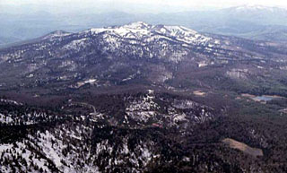
Akita-Yakeyama
Japan
39.964°N, 140.757°E; summit elev. 1366 m
All times are local (unless otherwise noted)
On 11 May, rapid movement of an older landslide was followed by a steam explosion that triggered mud flows and a small tephra emission. The event occurred at Sumikawa-Onsen (a hot spring resort) at the foot of Akita-Yakeyama, ~4 km NE of the summit. The following is based on a report by Shintaro Hayashi.
Although the landslide began moving a few days before 11 May, the sliding accelerated 20 minutes before the explosion. A field party saw the fast-moving landslide and took refuge prior to 0800 on 11 May. The explosion was witnessed at 0800 by a pilot flying over the area; he saw a water-and-steam column rising like a geyser, followed within seconds by black smoke emissions.
The explosion, heard as far as 1.4 km away, triggered a mudflow along the Akagawa River and eventually developed into a debris flow downstream. The field party noticed a thin coat of ash covering the mudflow deposits; they concluded that the tephra had issued from the explosion site.
Hayashi suggested that the explosion was triggered by sudden depressurization of a hot water reservoir under the hot spring due to removal of the overlying debris. The depressurization led to sudden boiling, generating sufficient steam pressure to explode. The volume of erupted material was estimated to be between 1,000 and 10,000 m3.
According to Hiroyuri Hamaguchi the precursory vibration and tremor were recorded by a short-period seismometer 1 km NNE of the hot spring. The landslide was as large as 500 m wide, 150 m long, and 500 m deep. After 2000 on 10 May, tremors of increasing amplitude built up. They declined by midnight and then returned at 0400 on 11 May. A maximum amplitude was reached at 0732, followed by a hiatus during 0753-0757. Short- and long-period events took place at 0757 and 0758, respectively.
Hayakawa reported that two hotels at the foot of Akita Yakeyama were completely destroyed by the landslide and lahar; however, there were no casualties because the staff and guests had evacuated. Air photos taken on 12 May by Asia Air Survey Co. can be seen on the internet.
Geological Summary. One of several Japanese volcanoes named Yakeyama ("Burning Mountain"), Akita-Yakeyama is the most recently active of a group of coalescing edifices in NW Honshu immediately west of Hachimantai volcano. The main volcano, Yakeyama, contains a small lava dome in its 600-m-wide summit crater. Tsugamori to the east is a stratovolcano of roughly the same height and has a 2-km-wide crater breached to the NE. The flat-topped lava dome of Kuroshimori lies 4 km S of Yakedake. One of several thermal areas, the Tamagawa Spa at the western foot has strongly acidic and slightly radioactive water. The last magmatic eruption formed the Onigajo lava dome in the summit crater about 5000 years ago. There have been somewhat uncertain reported 19th-century eruptions and mild phreatic eruptions in the 20th century.
Information Contacts: Shintaro Hayashi, Faculty of Education, Akita University, 1-1 Tegata-Gakuen-Cho, Akita 010, Japan; Hiroyuki Hamaguchi, Faculty of Science, Tohoku University, Sendai 980-77, Japan; Yukio Hayakawa, Faculty of Education, Gunma University, 4-2 Aramaki-machi, Mae-bashi-chi, Gunma 371, Japan (URL: http://www.hayakawayukio.jp/); Tatsuro Chiba, Dept of Disaster Prevention, Asia Air Survey Co., 4-2-18 Shinjuku, Shinjuku-ku, Tokyo 160, Japan (URL: http://www.ajiko.co.jp/en/).