Report on Papandayan (Indonesia) — July 1998
Bulletin of the Global Volcanism Network, vol. 23, no. 7 (July 1998)
Managing Editor: Richard Wunderman.
Papandayan (Indonesia) Minor phreatic explosions eject mud and gas on 23 June
Please cite this report as:
Global Volcanism Program, 1998. Report on Papandayan (Indonesia) (Wunderman, R., ed.). Bulletin of the Global Volcanism Network, 23:7. Smithsonian Institution. https://doi.org/10.5479/si.GVP.BGVN199807-263100
Papandayan
Indonesia
7.32°S, 107.73°E; summit elev. 2665 m
All times are local (unless otherwise noted)
The normal seismic activity of about ten events per day increased significantly after 20 June. Deep and shallow seismic events with large amplitudes were recorded during the last week of June and first few days of July. The increase also included events with low amplitude and long duration corresponding to gas emission from Emas Crater. Small phreatic explosions ejected gas and mud from fumarolic vents on 23 June, lofting material up to 5 m above the crater. A white plume under moderate pressure reached heights of 10-100 m in the first week of July. After 20 June there was an increased amount of A-type seismicity, but B-type, tectonic, and emission earthquakes changed little or decreased (table 1). Tremors and felt shocks began to be recorded at this time.
Table 1. Daily seismic events at Papandayan in late June and early July 1998. Data courtesy of VSI.
| Date | Volcanic A | Volcanic B | Tectonic | Emission | Tremor | Felt Shock |
| 22 Jun-29 Jun 1998 | 26 | 80 | 36 | 162 | -- | -- |
| 30 Jun-05 Jul 1998 | 83 | 39 | 39 | 15 | 11 | 1 |
The Volcanological Survey of Indonesia (VSI) installed four telemetric seismographs and eight temporary data-loggers around Papandayan. On 3 July they installed an infrasonic microphone on the crater to monitor the eruption.
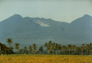
Geological Summary. Papandayan is a complex stratovolcano with four large summit craters, the youngest of which was breached to the NE by collapse during a brief eruption in 1772 and contains active fumarole fields. The broad 1.1-km-wide, flat-floored Alun-Alun crater truncates the summit of Papandayan, and Gunung Puntang to the north gives a twin-peaked appearance. Several episodes of collapse have created an irregular profile and produced debris avalanches that have impacted lowland areas. A sulfur-encrusted fumarole field occupies historically active Kawah Mas ("Golden Crater"). After its first historical eruption in 1772, in which collapse of the NE flank produced a catastrophic debris avalanche that destroyed 40 villages and killed nearly 3000 people, only small phreatic eruptions had occurred prior to an explosive eruption that began in November 2002.
Information Contacts: Volcanological Survey of Indonesia, Jalan Diponegoro No.57, Bandung 40122, Indonesia (URL: http://www.vsi.esdm.go.id/).