Report on Slamet (Indonesia) — August 1999
Bulletin of the Global Volcanism Network, vol. 24, no. 8 (August 1999)
Managing Editor: Richard Wunderman.
Slamet (Indonesia) Ash emissions June-September; new seismograph measures constant tremor
Please cite this report as:
Global Volcanism Program, 1999. Report on Slamet (Indonesia) (Wunderman, R., ed.). Bulletin of the Global Volcanism Network, 24:8. Smithsonian Institution. https://doi.org/10.5479/si.GVP.BGVN199908-263180
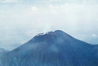
Slamet
Indonesia
7.242°S, 109.208°E; summit elev. 3428 m
All times are local (unless otherwise noted)
Moderate eruptive activity at Slamet, including ash emission and seismicity of varying intensity, continued during June-September. On most days during this period a "thick white plume of ash" rose as high as 600 m above the summit. The thickness of the ash cloud increased in September.
A new PS-2 type seismograph was added to the existing seismic monitoring network on 29 May. Tremor with amplitudes ranging from 0.5 to 15 mm was the dominant seismic type recorded during June. During 15-21 June tremor amplitudes ranged from 3-30 mm. In July small explosion earthquakes prevailed. Beginning in late July and continuing to 20 September, tremor was nearly constant with amplitudes up to 15 mm. Seismicity tended to increase toward the end of September (figure 2).
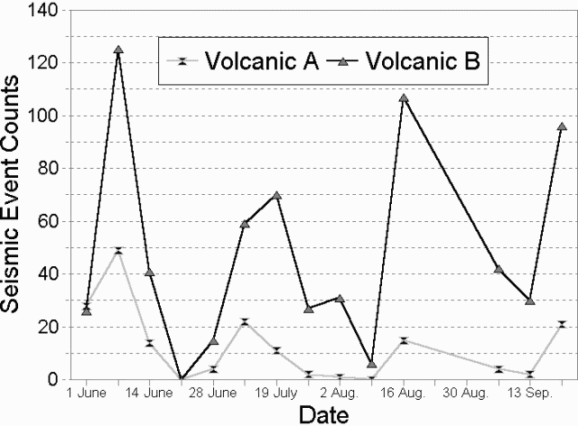 |
Figure 2. Number of volcanic earthquakes (A- and B-type) recorded at Slamet during June-September 1999. Data courtesy of VSI. |
Geological Summary. Slamet is one of Java's most active volcanoes. It has a cluster of about three dozen cinder cones on its lower SE-NE flanks and a single cinder cone on the W flank. It is composed of two overlapping edifices, an older basaltic andesite to andesitic volcano on the west and a younger basaltic to basaltic andesite one on the east. Gunung Malang II cinder cone on the upper E flank on the younger edifice fed a lava flow that extends 6 km E. Four craters occur at the summit of Gunung Slamet, with activity migrating to the SW over time. Eruptions recorded since the 18th century have originated from a 150-m-deep, 450-m-wide, steep-walled crater at the western part of the summit and have consisted of explosive eruptions generally lasting a few days to a few weeks.
Information Contacts: Volcanological Survey of Indonesia (VSI), Jalan Diponegoro No. 57, Bandung 40122, Indonesia (URL: http://www.vsi.esdm.go.id/).