Report on Talang (Indonesia) — September 2002
Bulletin of the Global Volcanism Network, vol. 27, no. 9 (September 2002)
Managing Editor: Richard Wunderman.
Talang (Indonesia) Plume reached up to 100 m above the crater during July 2002
Please cite this report as:
Global Volcanism Program, 2002. Report on Talang (Indonesia) (Wunderman, R., ed.). Bulletin of the Global Volcanism Network, 27:9. Smithsonian Institution. https://doi.org/10.5479/si.GVP.BGVN200209-261160
Talang
Indonesia
0.979°S, 100.681°E; summit elev. 2575 m
All times are local (unless otherwise noted)
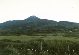
During 17 June-28 July 2002 at Talang a generally white, thin plume rose 25-100 m above the crater and drifted E. [Throughout July the activity was described as a "white-thin ash plume."] Hot spring temperatures ranged from 43 to 64°C. No seismic data were available because of a broken seismograph. Talang remained at Alert Level 2.
Geological Summary. Talang, which forms a twin volcano with the extinct Pasar Arbaa volcano, lies ESE of the major city of Padang and rises NW of Dibawah Lake. Talang has two crater lakes on its flanks; the largest of these is 1 x 2 km wide Danau Talang. The summit exhibits fumarolic activity, but which lacks a crater. Historical eruptions have mostly involved small-to-moderate explosive activity first documented in the 19th century that originated from a series of small craters in a valley on the upper NE flank.
Information Contacts: Volcanological Survey of Indonesia (VSI), Jalan Diponegoro No. 57, Bandung 40122, Indonesia (URL: http://www.vsi.esdm.go.id/).