Report on Nyamulagira (DR Congo) — October 2002
Bulletin of the Global Volcanism Network, vol. 27, no. 10 (October 2002)
Managing Editor: Richard Wunderman.
Nyamulagira (DR Congo) Multi-vent eruption, 25 July-27 September 2002; regional earthquake
Please cite this report as:
Global Volcanism Program, 2002. Report on Nyamulagira (DR Congo) (Wunderman, R., ed.). Bulletin of the Global Volcanism Network, 27:10. Smithsonian Institution. https://doi.org/10.5479/si.GVP.BGVN200210-223020
Nyamulagira
DR Congo
1.408°S, 29.2°E; summit elev. 3058 m
All times are local (unless otherwise noted)
An eruption began at Nyamuragira on 25 July 2002 (BGVN 27:07). Flights on 1 and 3 August confirmed that the eruption was continuing at a high rate, but another look on 27 September showed that the eruption had ceased. An unusually large earthquake (Mw 6.1-6.2) and its aftershock (Mw 5.5) struck the region on 24 October 2002.
During 6-8 August a team composed of scientists from the Goma Volcano Observatory (GVO) (Kaseraka Mahinda and François Lukaya) and a UN-OCHA consultant volcanologist (Jacques Durieux) made a survey trip to the active eruption site of Nyamuragira. The team landed by helicopter in the summit caldera, reached the eruption site by foot, and spent 24 hours on the scene.
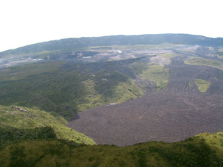
The team saw the eruption at 0330 on 25 July with lava venting at 3 different fractures, or fracture systems. One fracture was open in the central caldera, and lava flows had covered a major part of the floor and partially filled the pit crater (Crater B). Another fracture was active on the S flank, with lava fountains and one lava flow traveling towards the SW. This fracture was active during the first hours of the eruption only.
N-flank fractures had opened and extended for ~2 km, reaching from the crater rim (2,959 m) down to an elevation of ~2,540 m. At the beginning of the activity, lava fountains appeared along the fractures and spatter accumulated around them. Numerous lava flows (pahoehoe and aa) were emitted from several points of the fracture system. Both the fountaining and the presence of multiple fissure vents followed Nyamuragira's usual eruptive pattern.
On 6 August only the lower part of the fracture was active; a cone (several hundreds meters long, ~70 m high) contained three very active lava fountains ejecting scoria to an altitude of ~100 m. From a breach in the lowest part of the cone (on the S), very fast moving lava flowed NE. At that time the lava extrusion rate was ~3 x 10⁶ m3 per day, a typical value at this volcano. The activity of fountaining and lava emission regained some intensity at the beginning of the night but dropped dramatically during the early morning of 7 August. At that time, only one weak lava fountain remained active in the new crater. Decreasing tremor registered across GVO's seismic network, and low tremor prevailed on the morning of 8 August.
An overflight on 27 September confirmed the end of this eruptive episode when observers failed to see any still-active lava flow and the eruptive cones displayed only fumaroles. At that time, however, weak tremor still consistently registered, with slightly less at Nyamuragira (Katale station) than at Nyiragongo (Rusayo station). Nyamuragira also was the scene of a greater number of high frequency (HF) and long-period (LP) earthquakes.
A large tectonic earthquake (Mw 6.1-6.2; mb 5.8; Ms 6.3), one of the two largest in at least 30 years, occurred on 24 October. A second large-magnitude event (Mw 5.5) occurred about an hour later. For further details on these events, see the text and tables in the section "Regional seismicity" within the report on Nyiragongo in this Bulletin.
Geological Summary. Africa's most active volcano, Nyamulagira (also known as Nyamuragira), is a massive high-potassium basaltic shield about 25 km N of Lake Kivu and 13 km NNW of the steep-sided Nyiragongo volcano. The summit is truncated by a small 2 x 2.3 km caldera that has walls up to about 100 m high. Documented eruptions have occurred within the summit caldera, as well as from the numerous flank fissures and cinder cones. A lava lake in the summit crater, active since at least 1921, drained in 1938, at the time of a major flank eruption. Recent lava flows extend down the flanks more than 30 km from the summit as far as Lake Kivu; extensive lava flows from this volcano have covered 1,500 km2 of the western branch of the East African Rift.
Information Contacts: Kasereka Mahinda and François Lukaya, Goma Volcano Observatory, Departement de Geophysique, Centre de Recherche en Sciences Naturelles, Lwiro, D.S. Bukavu, DR Congo; Jacques Durieux, Resident Volcanologist, United Nations Office for the Coordination of Humanitarian Affairs (OCHA), United Nations, New York, NY 10017 USA (URL: https://reliefweb.int/).

