Report on Barren Island (India) — February 2003

Bulletin of the Global Volcanism Network, vol. 28, no. 2 (February 2003)
Managing Editor: Edward Venzke.
Barren Island (India) Fumarolic activity noted during fieldwork in February
Please cite this report as:
Global Volcanism Program, 2003. Report on Barren Island (India) (Venzke, E., ed.). Bulletin of the Global Volcanism Network, 28:2. Smithsonian Institution. https://doi.org/10.5479/si.GVP.BGVN200302-260010
Barren Island
India
12.278°N, 93.858°E; summit elev. 354 m
All times are local (unless otherwise noted)
A team of scientists from India and Italy carried out detailed geological, volcanological, geochemical, and geothermal investigations on Barren Island (figures 4 and 5) during 3-6 February 2003. The scientific team, led by Dornadula Chandrasekharam, included Piero Manetti, Orlando Vaselli, Bruno Capaccioni, and Mohammad Ayaz Alam. The Indian Coast Guard vessel CGS Lakshmi Bai carried the team from Port Blair on 3 February 2003; the journey takes ~5-6 hours depending on sea conditions. Because of the great depths around the island, it is not possible to anchor, so the team was ferried to the island in a small rubber boat. After the ship returned on the morning of 6 February, a trip around the island was made to see the steep seaward face of the prehistoric caldera wall.
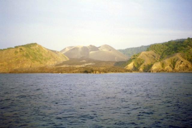 |
Figure 4. Barren Island as seen from the vessel CGS Lakshmi Bai on 3 February 2003. Courtesy of D. Chandrasekharam and others. |
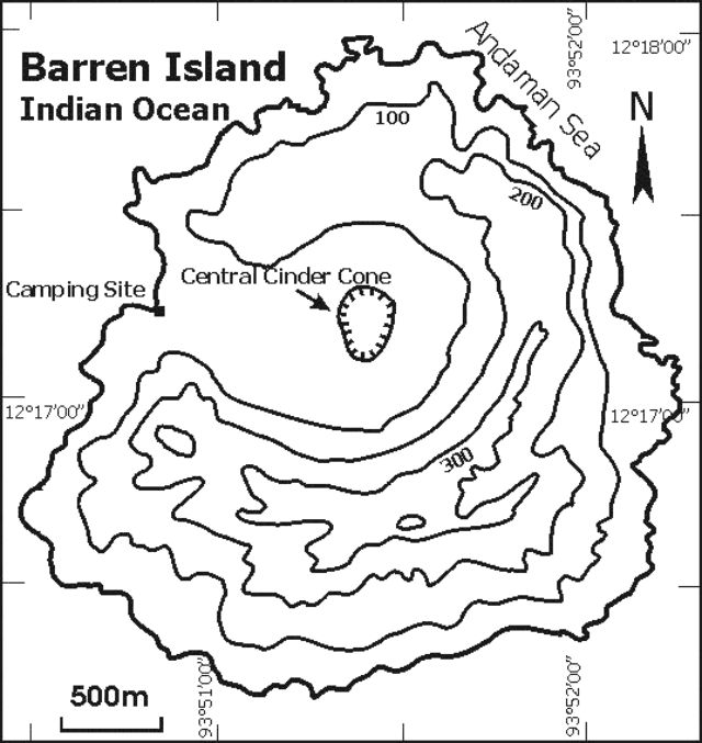 |
Figure 5. Preliminary sketch map of Barren Island. Courtesy of D. Chandrasekharam and others. |
The volcano consists of a caldera, which opens towards the W, with a central polygenetic vent enclosing at least five nested tuff cones. Two spatter cones are located on the W and SE flanks of the central cone (figure 6).
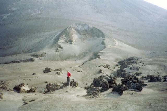 |
Figure 6. A spatter cone on the SW flank of the central cinder cone at Barren Island around 3 February 2003. Courtesy of D. Chandrasekharam and others. |
An eruption in 1991 ended more than 200 years of quiescence. Another eruption in 1994-95 left two spatter cones on its SE and W flanks. From these vents two aa lava flows poured out, both reaching the sea, during two distinct eruptive phases separated by ashfall. The lava flow created a delta into the sea (figure 7). There has been no documented eruptive activity since 1995, but Indian Coast Guards informed the team of renewed activity (strong gas and possible lava emission) in January 2000. The volcano currently exhibits continuing fumarolic activity. Steaming ground was visible at numerous places on the island.
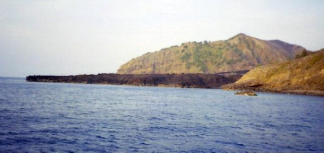 |
Figure 7. Lava from the 1994-95 eruptions on Barren Island formed a tongue that reached the sea. Courtesy of D. Chandrasekharam and others. |
On 5 February the team climbed the summit of the central cinder cone that showed strongly fumarolic (but not presently active) areas with layers of sulfur deposits (figure 8). The ascent to the crater was relatively difficult since the material on the very steep slope was loose (figure 9). Neither magma nor gas emissions were observed within the craters of the different cones. From the middle to the upper part of the W cone, the ground temperature was relatively high (>40°C), and steaming ground was visible at different sites. Fumarolic activity, with temperatures up to 101°C, was mainly concentrated along the upper crater wall of the SW cone. Blue fumes (indicative of SO2) and the aroma of acidic gases such as HCl were not recorded.
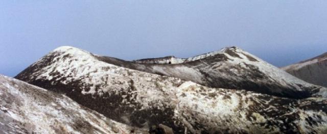 |
Figure 8. Fumarolic deposit on top of the central cinder cone at Barren Island on 5 February 2003. Courtesy of D. Chandrasekharam and others. |
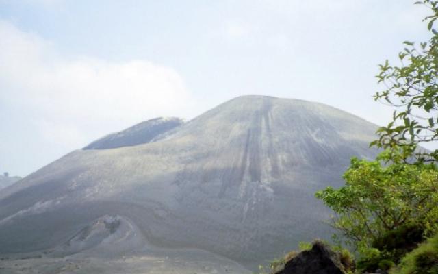 |
Figure 9. Central cinder cone showing steep slopes at Barren Island on 5 February 2003. Courtesy of D. Chandrasekharam and others. |
The pre-caldera deposits were characterized by more than five lava flows (prehistoric?) separated by scoria-fall beds and minor ash, tuff, and cinder deposits. The lava flows varied in thickness from 2 to 3 m, whereas the pyroclastic layers vary in thickness from 1 to 4 m. These lava flows could be clearly seen towards the N part of the main caldera. Towards the SE part of the inner caldera a 5-m-wide, NNE-SSW trending dike was observed. This feeder dike was fine-to-medium grained and contains buff-colored olivine, green pyroxene, and plagioclase phenocrysts. The N and NW part of the caldera has been mantled by a ~50-m-thick sequence of breccias and tuff representing syn/post-caldera phreatic and hydromagmatic activity, whereas the products of a small littoral cone occured mainly towards the W side. The lava flows of the main caldera were highly porphyritic with phenocrysts of green pyroxene (~3 cm) and plagioclase feldspars. Several steam vents could be seen within the 1994-95 lava flows. Some of these vents exhibited a lack of steam emanations at the time of the visit.
The outer and part of the inner caldera contains thick vegetation, which escaped the fury of the recent eruptions. Feral goats and rats dominate the island. Two fresh-water springs were discovered towards the SE part of the caldera. This is possibly the fresh water source for the goats living in this island. Chemical analysis indicates that the water from the springs is potable.
Geological Summary. Barren Island, a possession of India in the Andaman Sea about 135 km NE of Port Blair in the Andaman Islands, is the only historically active volcano along the N-S volcanic arc extending between Sumatra and Burma (Myanmar). It is the emergent summit of a volcano that rises from a depth of about 2250 m. The small, uninhabited 3-km-wide island contains a roughly 2-km-wide caldera with walls 250-350 m high. The caldera, which is open to the sea on the west, was created during a major explosive eruption in the late Pleistocene that produced pyroclastic-flow and -surge deposits. Historical eruptions have changed the morphology of the pyroclastic cone in the center of the caldera, and lava flows that fill much of the caldera floor have reached the sea along the western coast.
Information Contacts: Dornadula Chandrasekharam, Department of Earth Sciences, Indian Institute of Technology, Bombay 400076, India (URL: http://www.geos.iitb.ac.in/index.php/dc); Piero Manetti, Italian National Science Council (CNR), Institute of Geosciences and Earth Resources (CNR-IGG), Viale Moruzzi, 1, 56124 Pisa, Italy; Orlando Vaselli, Department of Earth Sciences, University of Florence, Via G. La Pira, 4 - 50121 Florence, Italy; Bruno Capaccioni, Institute of Volcanology and Geochemistry, University of Urbino, Loc. La Crocicchia, 61029 Urbino, Italy; Mohammad Ayaz Alam, Research Scholar, Department of Earth Sciences, Indian Institute of Technology, Bombay 400076, India.