Report on Kikai (Japan) — April 2003
Bulletin of the Global Volcanism Network, vol. 28, no. 4 (April 2003)
Managing Editor: Edward Venzke.
Kikai (Japan) Eruption plumes and ashfall during 24 May-5 June 2002
Please cite this report as:
Global Volcanism Program, 2003. Report on Kikai (Japan) (Venzke, E., ed.). Bulletin of the Global Volcanism Network, 28:4. Smithsonian Institution. https://doi.org/10.5479/si.GVP.BGVN200304-282060
Kikai
Japan
30.793°N, 130.305°E; summit elev. 704 m
All times are local (unless otherwise noted)
According to a Japanese Meteorological Agency (JMA) report on 6 June 2002, discolored plumes associated with volcanic tremor had intermittently issued from Kikai since 11 May 2002. The U.S. Air Force Weather Agency reported that plumes emanating from Satsuma-Iwo-jima (an island forming part of the NW caldera rim of Kikai) were visible on satellite imagery during 24-28 May and 1-4 June 2002. The thin plumes drifted to the S, SE, and E during May, and were estimated to be lower than 3 km altitude. Ash was seen from the island of Yaku-shima on the afternoon of 26 May. JMA noted that the number of small volcanic earthquakes increased after 29 May. The JMA report also stated that discolored plumes were observed from Mishima village in the Ryukyu Islands, and that ash fell on residential areas, during 3-5 June 2002.
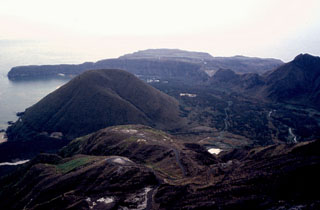
Geological Summary. Multiple eruption centers have exhibited recent activity at Kikai, a mostly submerged, 19-km-wide caldera near the northern end of the Ryukyu Islands south of Kyushu. It was the source of one of the world's largest Holocene eruptions about 6,300 years ago when rhyolitic pyroclastic flows traveled across the sea for a total distance of 100 km to southern Kyushu, and ashfall reached the northern Japanese island of Hokkaido. The eruption devastated southern and central Kyushu, which remained uninhabited for several centuries. Post-caldera eruptions formed Iodake (or Iwo-dake) lava dome and Inamuradake scoria cone, as well as submarine lava domes. Recorded eruptions have occurred at or near Satsuma-Iojima (also known as Tokara-Iojima), a small 3 x 6 km island forming part of the NW caldera rim. Showa-Iojima lava dome (also known as Iojima-Shinto), a small island 2 km E of Satsuma-Iojima, was formed during submarine eruptions in 1934 and 1935. Mild-to-moderate explosive eruptions have occurred during the past few decades from Iodake, a rhyolitic lava dome at the eastern end of Satsuma-Iojima.
Information Contacts: Naokuni Uchida, Japan Meteorological Agency (JMA), Fukuoka, Japan (URL: http://www.jma.go.jp/); Volcano Research Center, Earthquake Research Institute, University of Tokyo, Yayoi 1-1-1, Bunkyo-ku, Tokyo 113-0032, Japan (URL: http://www.eri.u-tokyo.ac.jp/VRC/index_E.html); Charles Holliday, U.S. Air Force Weather Agency, 106 Peacekeeper Drive, Ste 2NE, Offut AFB, NE 68113-4039, USA (URL: http://www.557weatherwing.af.mil/).