Report on Egon (Indonesia) — August 2004
Bulletin of the Global Volcanism Network, vol. 29, no. 8 (August 2004)
Managing Editor: Richard Wunderman.
Egon (Indonesia) Explosive ash eruptions in July and August; ashfall and evacuations
Please cite this report as:
Global Volcanism Program, 2004. Report on Egon (Indonesia) (Wunderman, R., ed.). Bulletin of the Global Volcanism Network, 29:8. Smithsonian Institution. https://doi.org/10.5479/si.GVP.BGVN200408-264160
Egon
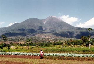
Indonesia
8.676°S, 122.455°E; summit elev. 1661 m
All times are local (unless otherwise noted)
Volcanic activity began at Egon in late January when ash explosions caused local ashfall (BGVN 29:03). Activity subsequently decreased, and evacuated residents returned home. Reports from the Directorate of Volcanology and Geological Hazard Mitigation (DVGHM) indicated that in May 2004 only ten A-type volcanic earthquakes were detected. These types of events increased to 19 during June, when three shallow B-type volcanic earthquakes were also registered (table 1).
Table 1. Seismicity at Egon during 20 June-29 August 2004. Courtesy of DVGHM.
| Date | Volcanic A | Volcanic B | Tremor | Tectonic |
| 20 Jun-27 Jun 2004 | 7 | 2 | -- | 23 |
| 28 Jun-04 Jul 2004 | 9 | 3 | -- | 24 |
| 05 Jul-11 Jul 2004 | 9 | 2 | continuous | 2 |
| 12 Jul-18 Jul 2004 | 22 | 139 | 2 | 35 |
| 19 Jul-25 Jul 2004 | 17 | 109 | -- | 54 |
| 26 Jul-01 Aug 2004 | 5 | 37 | -- | 28 |
| 02 Aug-08 Aug 2004 | 3 | 38 | 34 | 28 |
| 09 Aug-15 Aug 2004 | 2 | 49 | 49 | 16 |
| 16 Aug-22 Aug 2004 | 1 | 70 | 51 | 16 |
| 23 Aug-29 Aug 2004 | 4 | 90 | 42 | 17 |
Volcanism resumed at 1930 on 3 July 2004 when small explosions along with rumbling sounds and a white- gray ash plume rose 100 m and caused ashfall to the SE. Ash from a second small explosion that began with increasing A-type volcanic earthquakes on 6 July at 0100 again drifted SE. Maximum amplitudes (peak-to-peak) of the explosion earthquakes were 1 mm and lasted 60 seconds. White plumes rising to ~ 75 m above the summit were then observed during 5-18 July. Continuous emission earthquakes were recorded during the week of 5-12 July with 2 mm amplitude. After 11 July a PS-2 telemetered seismograph was operational.
A significant ash explosion accompanied by rumbling sounds at 2240 on 25 July 2004 sent a plume ~ 1,000-1,500 m above the summit. A thick black ash column drifted NW and the smell of sulfur gas was very strong. Seismic data indicated that the eruptions lasted about 2 hours and 30 minutes; tremor amplitude was 30-35 mm. Ashfall affected the Egon (3 km NW) and Nangatobong (7.5 km NNW) villages, and 339 families evacuated to Waigete. Daily seismic events increased from 14 to 36 prior to the eruption. Ash explosions continued through 1600 the next day, sending plumes ~ 250 m above the summit at intervals of about a minute. Additional evacuations occurred from Egon, Nangatobong, and Itoper villages. Another explosion at 2200 on 28 July sent volcanic material to a height of 750 m; ash drifted WSW. Recorded tremor emission showed maximum amplitudes decreasing from 5 mm to 2 mm.
By the week of 9-15 August observers were only reporting a thin white plume to ~ 100 m above the summit, although tremor was still being recorded. Similar activity continued through 22 August. On 27 August two eruptions ejected ash plumes more than 250 m high. Shallow volcanic earthquakes increased significantly during the week of 23-29 August.
Geological Summary. Gunung Egon, also known as Namang, sits within the narrow section of eastern Flores Island. The barren, sparsely vegetated summit region has a 350-m-wide, 200-m-deep crater that sometimes contains a lake. Other small crater lakes occur on the flanks. A lava dome forms the southern summit. Solfataric activity occurs on the crater wall and rim and on the upper S flank. Reports of eruptive activity prior to explosive eruptions beginning in 2004 are unconfirmed. Emissions were often observed above the summit during 1888-1892. Strong emissions in 1907 reported by Sapper (1917) was considered by the Catalog of Active Volcanoes of the World (Neumann van Padang, 1951) to be an historical eruption, but Kemmerling (1929) noted that this was likely confused with an eruption on the same date and time from Lewotobi Lakilaki.
Information Contacts: Dali Ahmad, Hetty Triastuty, Nia Haerani, Suswati, and Sri Kisyati, Directorate of Volcanology and Geological Hazard Mitigation, Jalan Diponegoro No. 57, Bandung 40122, Indonesia, URL: http://www.vsi.esdm.go.id/).