Report on Marion Island (South Africa) — February 2005
Bulletin of the Global Volcanism Network, vol. 30, no. 2 (February 2005)
Managing Editor: Richard Wunderman.
Marion Island (South Africa) Small eruption seen 24 June 2004 on S side of this Antarctic island
Please cite this report as:
Global Volcanism Program, 2005. Report on Marion Island (South Africa) (Wunderman, R., ed.). Bulletin of the Global Volcanism Network, 30:2. Smithsonian Institution. https://doi.org/10.5479/si.GVP.BGVN200502-234070
Marion Island
South Africa
46.9°S, 37.75°E; summit elev. 1230 m
All times are local (unless otherwise noted)
A small volcanic eruption was observed on 24 June 2004 by a member of the South African National Antarctic Programme's (SANAP) over-wintering team on Marion Island (figure 1). While conducting fieldwork in a mountainous area on the S part of the island, David Heddings was able to video an eruption that comprised gas and small pieces of scoria (a few centimeters in diameter).
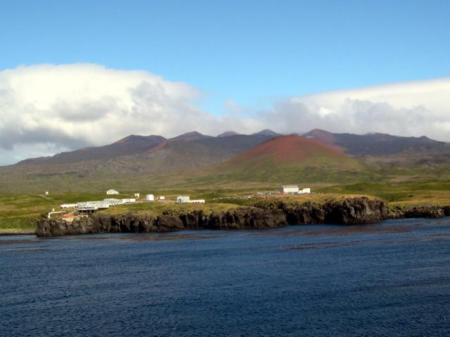 |
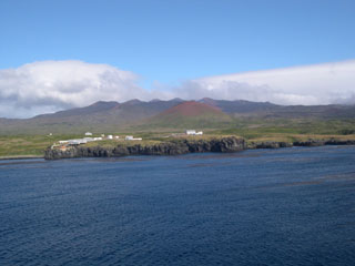
Figure 1. The SANAP base station, located on the E side of Marion Island. Courtesy of Ian Meiklejohn. |
While it has been assumed that small volcanic eruptions often take place on Marion Island, the remoteness and hilly terrain over much of the island has meant that such events have not been witnessed. The last confirmed eruption on Marion took place in 1980 when ornithologists found a fresh basaltic lava flow on the W side of the Island.
Geological Summary. Marion Island lies at the SW end of a submarine plateau immediately south of the SW Indian Ocean Ridge, opposite Prince Edward Island. The low profile of the 24-km-wide dominantly basaltic and trachybasaltic volcano is formed by two young shields that rise above a flat-topped submarine platform. The island includes about 150 cinder cones, smaller scoria cones, and coastal tuff cones. The earliest dated eruptions took place about 450,000 years ago, but much of the island is covered by Holocene aa and pahoehoe lava flows, and more than 130 scoria cones formed during the Holocene. Many of these appear younger than the 4,020 BP peat layer overlying one of the flows (Verwoerd, 1981). Unvegetated lava flows appear to be only a few hundred years old (Verwoerd, 1967). An eruption in 1980 produced explosive activity and lava flows from a 5-km-long fissure that extended from the summit to the west coast.
Information Contacts: Ian Meiklejohn and David Hedding, University of Pretoria, 0002, Pretoria, South Africa, 012-420 4049 (URL: http://www.up.ac.za/).