Report on Egon (Indonesia) — May 2005
Bulletin of the Global Volcanism Network, vol. 30, no. 5 (May 2005)
Managing Editor: Richard Wunderman.
Egon (Indonesia) Three eruptions in February 2005 eject ash and gas
Please cite this report as:
Global Volcanism Program, 2005. Report on Egon (Indonesia) (Wunderman, R., ed.). Bulletin of the Global Volcanism Network, 30:5. Smithsonian Institution. https://doi.org/10.5479/si.GVP.BGVN200505-264160
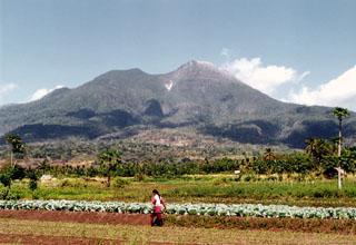
Egon
Indonesia
8.676°S, 122.455°E; summit elev. 1661 m
All times are local (unless otherwise noted)
Table 2 below tabulates the seismic activity by date of the volcano prior to and subsequent to its eruption on 6 February 2005, but little was reported concerning that event. The volcano erupted again on 7 February. That eruption was accompanied by a strong smell of SO2 or H2S in the villages of Hebing and Hale and apparently rendered a villager unconscious.
Table 2. A summary of counts for different earthquake types (type B volcanic, type A volcanic, emission, low frequency, and tectonic), tremor, amplitude, and Alert Level at Egon volcano. Unreported data indicated by "--". Courtesy of the Directorate of Volcanology and Geological Hazard Mitigation (DVGHM) DVGHM.
| Date | Volcanic B | Volcanic A | Emission | Low-frequency | Tectonic | Tremor amplitude | Alert Level |
| 05 Jan 2005 | 16 | 1 | 7 | 6 | 8 | 2-3 mm | 3 |
| 06 Jan 2005 | 48 | -- | 3 | -- | 7 | 1-2 mm | 3 |
| Week of 24 Jan 2005 | 48 | 1 | 1 | 53 | 18 | -- | 3 |
| Week of 01 Feb 2005 | 152 | 3 | -- | 109 | 76 | -- | -- |
| 14 Feb 2005 | 32 | 17 | -- | -- | 5 | 30 mm | 4 |
| 25-27 Feb 2005 | 61 | 4 | 24 | 2 | 19 | 1 mm | 4 |
On 8 February 2005 a fissure about 1 km long appeared along the southern slope. Vegetation along the fissure's margins had died, indicating that a gas blow out had occurred there. On 14 February 2005 at 1830 another explosion occurred. It was accompanied by significant seismic activity (see table 2). This latest eruption ejected ash and glowing material as high as 50 m above the summit. Volcanic earthquakes were frequent.
Distances increased for electronic distance measurements (EDM) during April, July, and October 2004 and during February 2005 (the last four measurements). During 25-27 February 2005 ash plumes rose to 50 m high. Volcano status remained at alert level 4 (the highest hazard status).
Geological Summary. Gunung Egon, also known as Namang, sits within the narrow section of eastern Flores Island. The barren, sparsely vegetated summit region has a 350-m-wide, 200-m-deep crater that sometimes contains a lake. Other small crater lakes occur on the flanks. A lava dome forms the southern summit. Solfataric activity occurs on the crater wall and rim and on the upper S flank. Reports of eruptive activity prior to explosive eruptions beginning in 2004 are unconfirmed. Emissions were often observed above the summit during 1888-1892. Strong emissions in 1907 reported by Sapper (1917) was considered by the Catalog of Active Volcanoes of the World (Neumann van Padang, 1951) to be an historical eruption, but Kemmerling (1929) noted that this was likely confused with an eruption on the same date and time from Lewotobi Lakilaki.
Information Contacts: Dali Ahmad, Hetty Triastuty, Nia Haerani, and Sri Kisyati, Directorate of Volcanology and Geological Hazard Mitigation (DVGHM), Jalan Diponegoro No. 57, Bandung 40122, Indonesia (URL: http://www.vsi.esdm.go.id/).