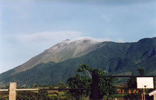
Report on Kanlaon (Philippines) — June 2005
Bulletin of the Global Volcanism Network, vol. 30, no. 6 (June 2005)
Managing Editor: Richard Wunderman.
Kanlaon (Philippines) May 2005 ash ejections ceasing after the 25th as monitored parameters declined
Please cite this report as:
Global Volcanism Program, 2005. Report on Kanlaon (Philippines) (Wunderman, R., ed.). Bulletin of the Global Volcanism Network, 30:6. Smithsonian Institution. https://doi.org/10.5479/si.GVP.BGVN200506-272020
Kanlaon
Philippines
10.4096°N, 123.13°E; summit elev. 2422 m
All times are local (unless otherwise noted)
Throughout May 2005, PHIVOLCS noted that ash-and-steam emissions from Canlaon produced plumes to 500-1,000 m above the volcano. The hazard status remained at Alert Level 1. The SO2 flux remained above the 'normal' level of 500 metric tons/day (t/d) with values of 2,700 t/d on 1 May, 2,080 on 22 May, and 1,400 on 26 May. According to news reports, flights to and from nearby Kalibo airport were suspended on 3 May due to reduced visibility.
Although voluminous white steam continued to be discharged from the active vent early in June 2005, after 25 May ash ejections stopped and ash contents in the steam plume were significantly reduced. On [30 June] PHIVOLCS lowered the hazard status of Canlaon from Alert Level 1 to Alert Level Zero, listing a variety of reasons. For one, they noted the downtrend in the SO2 gas emission rate from a high of about 4,900 t/d, to the prevailing level of 1,500 t/d. For another, they noted the absence of significant seismic activity before, during, and after the ash emissions. And finally, they cited a lack of significant observations indicating near-surface hydrothermal activity. Since Canlaon has a history of sudden outbursts, the public was reminded to refrain from entering the 4-km-radius Permanent Danger Zone (PDZ) and to coordinate with PHIVOLCS and Disaster Management Councils in any attempt to climb the volcano.
Geological Summary. Kanlaon volcano (also spelled Canlaon) forms the highest point on the Philippine island of Negros. The massive andesitic stratovolcano is covered with fissure-controlled pyroclastic cones and craters, many of which are filled by lakes. The largest debris avalanche known in the Philippines traveled 33 km SW from Kanlaon. The summit contains a 2-km-wide, elongated northern caldera with a crater lake and a smaller but higher active vent, Lugud crater, to the south. Eruptions recorded since 1866 have typically consisted of phreatic explosions of small-to-moderate size that produce minor local ashfall.
Information Contacts: Philippine Institute of Volcanology and Seismology (PHIVOLCS), Department of Science and Technology, PHIVOLCS Building, C.P. Garcia Avenue, Univ. of the Philippines Campus, Diliman, Quezon City, Philippines (URL: http://www.phivolcs.dost.gov.ph/); Chris Newhall, USGS, Box 351310, University of Washington, Seattle, WA 98195-1310, USA; Philippine Star (URL: http://www.philstar.com/).

