Report on Nyamulagira (DR Congo) — January 2006
Bulletin of the Global Volcanism Network, vol. 31, no. 1 (January 2006)
Managing Editor: Richard Wunderman.
Nyamulagira (DR Congo) To the N, swarms of long-period, along-rift earthquakes
Please cite this report as:
Global Volcanism Program, 2006. Report on Nyamulagira (DR Congo) (Wunderman, R., ed.). Bulletin of the Global Volcanism Network, 31:1. Smithsonian Institution. https://doi.org/10.5479/si.GVP.BGVN200601-223020
Nyamulagira
DR Congo
1.408°S, 29.2°E; summit elev. 3058 m
All times are local (unless otherwise noted)
Nyamuragira last erupted during May 2004; weak but steady ash emissions continued until 1 June 2004, when satellite imagery indicated that the eruption had ceased (BGVN 29:05). The volcano, whose name is sometimes written as Nyamlagira and Nyamulagira, was the scene of several seismic swarms in middle and late 2005.
On 6 July 2005, the Goma Volcano Observatory (GVO) reported that a significant seismic crisis had occurred at Nyamuragira in late June 2005. The crisis consisted of swarms of mainly long-period earthquakes, which increased in number daily and peaked on 26 and 27 June. Most of the events occurred within a 10 km radius around Nyamuragira's summit caldera and were aligned roughly N-S. The depths of the earthquakes ranged from 0 to 30 km, with two main areas of concentration; one between 15 and 25 km deep, and the other between 0 and 4 km. Based on precursory activity before previous historical eruptions at Nyamuragira, GVO reported that a new eruption might occur in the next 2-4 months. They stressed that an eruption would not threaten the city of Goma or other inhabited areas.
Beginning on 23 October 2005, GVO again recorded heightened seismic activity along the East African Rift and around the Virunga volcanoes when a swarm of long-period earthquakes occurred N of Nyamuragira. More than 140 events were recorded at a station 19 km E of the volcano. On 27 October at 1500, another swarm of long-period earthquakes began beneath the same area. More than 300 events were recorded until at least 28 October. At 2010 on that day, a M 4.5 tectonic earthquake occurred N of Lake Tanganika, followed by several aftershocks. The Alert Level for the nearby city of Goma remained at Yellow.
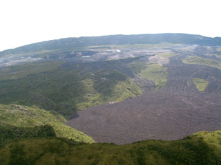
Geological Summary. Africa's most active volcano, Nyamulagira (also known as Nyamuragira), is a massive high-potassium basaltic shield about 25 km N of Lake Kivu and 13 km NNW of the steep-sided Nyiragongo volcano. The summit is truncated by a small 2 x 2.3 km caldera that has walls up to about 100 m high. Documented eruptions have occurred within the summit caldera, as well as from the numerous flank fissures and cinder cones. A lava lake in the summit crater, active since at least 1921, drained in 1938, at the time of a major flank eruption. Recent lava flows extend down the flanks more than 30 km from the summit as far as Lake Kivu; extensive lava flows from this volcano have covered 1,500 km2 of the western branch of the East African Rift.
Information Contacts: Baluku Bajope and Kasereka Mahinda, Observatoire Volcanologique de Goma, Departement de Geophysique, Centre de Recherche en Sciences Naturelles, Lwiro, D.S. Bukavu, DR Congo; Toulouse Volcanic Ash Advisory Center (VAAC), Météo-France, 42 Avenue Gaspard Coriolis, F-31057 Toulouse cedex, France (URL: http://www.meteo.fr/vaac/); TOMS Volcanic Emissions Group, NASA Goddard Space Flight Center, Code 613.3, Greenbelt, MD 20771, USA (URL: https://so2.gsfc.nasa.gov/).

