Report on Lateiki (Tonga) — December 2006
Bulletin of the Global Volcanism Network, vol. 31, no. 12 (December 2006)
Managing Editor: Richard Wunderman.
Lateiki (Tonga) Island present in December 2006; discolored water
Please cite this report as:
Global Volcanism Program, 2006. Report on Lateiki (Tonga) (Wunderman, R., ed.). Bulletin of the Global Volcanism Network, 31:12. Smithsonian Institution. https://doi.org/10.5479/si.GVP.BGVN200612-243070
Lateiki
Tonga
19.18°S, 174.87°W; summit elev. 43 m
All times are local (unless otherwise noted)
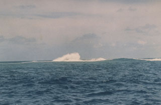
On 7 December 2006 the Royal New Zealand Air Force (RNZAF) flew over the Home Reef and Metis Shoal area of Tonga at the request of volcanologists from the Institute of Geological & Nuclear Sciences (IGNS). At that time an island was present (figure 4), but it is not known if this is a remnant of the island built in 1995 (BGVN 20:06) or the result of later undocumented eruptions. Areas of discolored water were present adjacent to the island, the result of either erosion or fumarolic activity. Discolored water extending about 5 km SW from the location of the island was also observed in an Aqua MODIS satellite image taken on 15 September 2005 (figure 5).
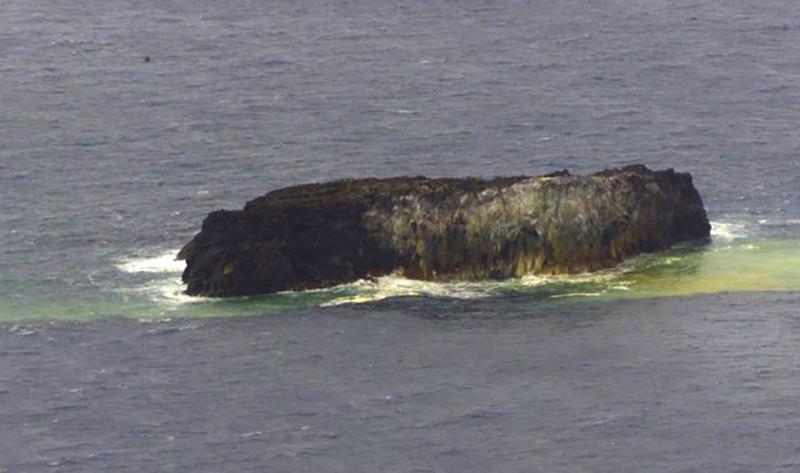 |
Figure 4. Photograph of Metis Shoal, 7 December 2006. Courtesy of the RNZAF and IGNS. |
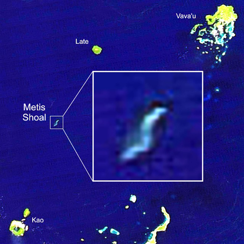 |
Figure 5. Satellite image (Aqua MODIS) from 15 September 2005 showing discolored water extending about 5 km SW from Metis Shoal. Image has been color-adjusted to enhance water discoloration. Base image courtesy of NASA Earth Observatory. |
Geological Summary. Lateiki, previously known as Metis Shoal, is a submarine volcano midway between the islands of Kao and Late that has produced a series of ephemeral islands since the first confirmed activity in the mid-19th century. An island, perhaps not in eruption, was reported in 1781 and subsequently eroded away. During periods of inactivity following 20th-century eruptions, waves have been observed to break on rocky reefs or sandy banks with depths of 10 m or less. Dacitic tuff cones formed during the eruptions in 1967 and 1979 were soon eroded beneath the ocean surface. An eruption in 1995 produced an island with a diameter of 280 m and a height of 43 m following growth of a lava dome above the surface.
Information Contacts: Brad Scott, Institute of Geological & Nuclear Sciences (IGNS), Wairakei Research Centre, PO Box 2000, Taupo, New Zealand (URL: http://www.geonet.org.nz/, http://www.gns.cri.nz/); NASA Earth Observatory (URL: http://earthobservatory.nasa.gov/).