Report on Bagana (Papua New Guinea) — November 2008

Bulletin of the Global Volcanism Network, vol. 33, no. 11 (November 2008)
Managing Editor: Richard Wunderman.
Bagana (Papua New Guinea) Lava flows and ash emissions from March to December 2008
Please cite this report as:
Global Volcanism Program, 2008. Report on Bagana (Papua New Guinea) (Wunderman, R., ed.). Bulletin of the Global Volcanism Network, 33:11. Smithsonian Institution. https://doi.org/10.5479/si.GVP.BGVN200811-255020
Bagana
Papua New Guinea
6.137°S, 155.196°E; summit elev. 1855 m
All times are local (unless otherwise noted)
Lava flows, pyroclastic flows, and repeated forceful ash emissions were noted at Bagana (figure 9) from June 2007 through March 2008 (BGVN 33:03). Lava flows and ash emissions continued from the end of May 2008 through 16 December 2008. No reports were received for April 2008.
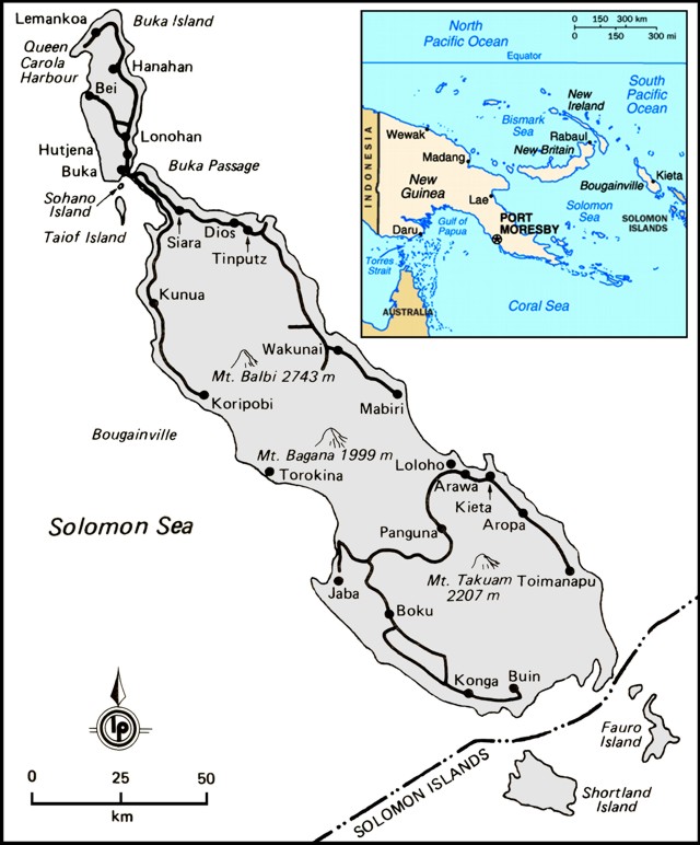 |
Figure 9. Map of Bougainville Island showing adjacent islands and key cities, including Arawa, the disputed capital and largest settlement of the province. Panguna is the location of an enormous gold- and silver-bearing porphyry-copper deposit in the volcanic highlands (Sillitoe, R. H., 1997), and the site of an open-pit mine which closed in 1989. A decade of civil war surrounding the mine hampered reporting on Bougainville's volcanoes. Base map modified from Lightbody and Wheeler (1985). |
In May 2008 the Rabaul Volcanological Observatory (RVO) noted that sluggish lava flowed from the summit towards the S and the Torokina River, along with small ash emissions from the summit that rose a few hundred meters. Smaller dust clouds formed from the lava flow fronts. Night glow was common, as were booming and rumbling noises. On 15 May 2008 the lava flows accelerated and the glow brightened. Activity was low during June. RVO noted variable volumes of white vapor from the summit crater. Occasional loud booming noises were heard, and on the night of 8 June, a weak glow was visible. RVO reports for August through much of December were absent.
Based on observations of satellite imagery, the Darwin Volcanic Ash Advisory Center published aviation advisories for Bagana. From May through December, eight low level ash plumes were observed (table 3). The highest was noted on 22 May, when the plume rose to 3.7 km altitude and drifted S at about 23 km/hour.
Table 3. Darwin VAAC advisories describing ash plumes from Bagana during May 2008 to December 2008.
| Date | Plume Altitude | Drift Directions | Remarks |
| 22 May 2008 | 3.7 km | S | ~23 km/hour |
| 16 Sep 2008 | 2.4 km | SW | -- |
| 22 Sep 2008 | 2.4 km | SW | -- |
| 08 Oct 2008 | 3 km | WSW | Extended 55-110 km |
| 20 Nov 2008 | 3 km | SW | Extended 75 km |
| 26 Nov 2008 | -- | W | -- |
| 02 Dec 2008 | 3 km | NW | -- |
| 16 Dec 2008 | 3 km | SW | -- |
MODVOLC. These satellite-derived infrared alerts were consistent with ongoing Bagana eruptions. As previously reported, MODIS/MODVOLC thermal alerts were abundant during 2006-2007 (BGVN 32:04) and through March 2008 (BGVN 33:03). Thermal alerts continued to be detected from April through the end of December 2008. During this time, the alerts were issued 4-12 times per month. The system, using MODIS (the Moderate Resolution Imaging Spectroradiometer) and the MODVOLC algorithm, is processed by the staff at the Hawaii Institute of Geophysics and Planetology (HIGP).
References. Sillitoe, R. H., 1997, Characteristics and controls of the largest porphyry copper-gold and epithermal gold deposits in the circum-Pacific region: Australian Journal of Earth Sciences, v. 44, no. 3, p. 373-388.
Lightbody, M., and Wheeler, T., 1985, Papua New Guinea, a travel survival kit: Lonely Planet Publications, 256 p., ISBN 0 908086 59 8.
Geological Summary. Bagana volcano, in a remote portion of central Bougainville Island, is frequently active. This massive symmetrical cone was largely constructed by an accumulation of viscous andesitic lava flows. The entire edifice could have been constructed in about 300 years at its present rate of lava production. Eruptive activity is characterized by non-explosive effusion of viscous lava that maintains a small lava dome in the summit crater, although occasional explosive activity produces pyroclastic flows. Lava flows with tongue-shaped lobes up to 50 m thick and prominent levees descend the flanks on all sides.
Information Contacts: Rabaul Volcanological Observatory (RVO), Dept of Mining, Private Mail Bag, Port Moresby Post Office, National Capitol District, Papua New Guinea (URL: http://www.pngndc.gov.pg/); Darwin Volcanic Ash Advisory Centre (VAAC), Bureau of Meteorology, Northern Territory Regional Office, PO Box 40050, Casuarina, NT 0811, Australia (URL: http://www.bom.gov.au/info/vaac/); Hawai'i Institute of Geophysics and Planetology (HIGP) Thermal Alerts System, School of Ocean and Earth Science and Technology (SOEST), Univ. of Hawai'i, 2525 Correa Road, Honolulu, HI 96822, USA (URL: http://modis.higp.hawaii.edu/).