Report on Tongariro (New Zealand) — January 2009
Bulletin of the Global Volcanism Network, vol. 34, no. 1 (January 2009)
Managing Editor: Richard Wunderman.
Tongariro (New Zealand) High seismicity in January 2008; declined to background by mid-year
Please cite this report as:
Global Volcanism Program, 2009. Report on Tongariro (New Zealand) (Wunderman, R., ed.). Bulletin of the Global Volcanism Network, 34:1. Smithsonian Institution. https://doi.org/10.5479/si.GVP.BGVN200901-241080
Tongariro
New Zealand
39.157°S, 175.632°E; summit elev. 1978 m
All times are local (unless otherwise noted)
Our most recent report on Tongariro (BGVN31:12) discussed elevated seismicity during May-October 2006. The M < 2 long-period seismic event occurred near Ngāuruhoe, the youngest cone of the Tongariro volcanic complex.
Between 1 November 2006 and January 2008, elevated, low-level volcanic earthquakes continued at Ngāuruhoe. The number of events per day typically ranged between 5 and 30. Then, on 6 January 2008, the number of events per day began to increase, and by 9-10 January the number had shot up to 80 per day, before decreasing slightly. The larger events ranged between M 1.2 and 1.5.
In response to these changes, volcanologists from GeoNet visited on 17 January 2008 and measured gas concentrations, temperatures, and soil gas flux at the summit area of Ngāuruhoe. The resulting data were similar to measurements made in 2006-2007. The maximum fumarole temperature near the summit remained about 86°C. No other signs of unrest were found. The data suggested that the earthquakes were occurring within about 1 km of the surface beneath the N flank.
GeoNet noted that the number of volcanic earthquakes since mid-2008 has declined to background levels. Regular measurements of volcanic gas levels and the temperature of the summit gas vent have showed no changes over the previous two and a half years. Consequently, on 2 December 2008, the Alert Level was lowered from 1 to 0 (typical background activity). No thermal anomalies have been measured by MODIS/MODVOLC satellites (HIGP Hot Spots System) in the at least the past 5 years.
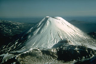
Geological Summary. Tongariro is a large volcanic massif, located immediately NE of Ruapehu volcano, that is composed of more than a dozen composite cones constructed over a period of 275,000 years. Vents along a NE-trending zone extending from Saddle Cone (below Ruapehu) to Te Maari crater (including vents at the present-day location of Ngauruhoe) were active during several hundred years around 10,000 years ago, producing the largest known eruptions at the Tongariro complex during the Holocene. North Crater stratovolcano is truncated by a broad, shallow crater filled by a solidified lava lake that is cut on the NW side by a small explosion crater. The youngest cone, Ngauruhoe, is also the highest peak.
Information Contacts: New Zealand GeoNet Project, a collaboration between the Earthquake Commission and GNS Science, Wairakei Research Centre, Private Bag 2000, Taupo 3352, New Zealand (URL: http://www.geonet.org.nz/); Hawai'i Institute of Geophysics and Planetology (HIGP) Hot Spots System, University of Hawai'i, 2525 Correa Road, Honolulu, HI 96822, USA (URL: http://modis.higp.hawaii.edu/).