Report on Karangetang (Indonesia) — January 2009
Bulletin of the Global Volcanism Network, vol. 34, no. 1 (January 2009)
Managing Editor: Richard Wunderman.
Karangetang (Indonesia) A 2007 plume rose to 12.2 km altitude; incandescent rockfalls
Please cite this report as:
Global Volcanism Program, 2009. Report on Karangetang (Indonesia) (Wunderman, R., ed.). Bulletin of the Global Volcanism Network, 34:1. Smithsonian Institution. https://doi.org/10.5479/si.GVP.BGVN200901-267020
Karangetang
Indonesia
2.781°N, 125.407°E; summit elev. 1797 m
All times are local (unless otherwise noted)
The August 2007 eruptive activity reported in BGVN 32:08 subsided at the beginning of September 2007. Accordingly, the Center of Volcanology and Geological Hazard Mitigation (CVGHM) lowered the hazard alert status from 4 to 3 (on a scale of 1-4). The next notable observation was a report from the Darwin Volcanic Ash Advisory Center (VAAC) of a possible eruption on 4 October 2007 based on satellite imagery of a plume that rose to 12.2 km altitude.
On 13 and 21 October 2007, the Darwin VAAC reported that pilots had observed ash plumes at altitudes near that of the summit. Minor tremor was recorded on 30 October, and the crater continued to emit diffuse white plumes up to 100 m above the crater. On 23 November CVGHM lowered the alert status from 3 to 2 due to a decrease in both seismicity and observed plume height and density.
A pilot observation of a low-level ash plume on 12 March 2008 was reported by the Darwin VAAC. On 28 November 2008, CVGHM reported that increased seismicity indicated rockfalls, along with white plumes from summit craters I and II. On 29 November white and brownish plumes were emitted to low altitudes. Incandescent rockslides from the main crater traveled 250 m S towards the Bahembang River, 250 m W towards the Beha Timur River, and 500-1,000 m S towards the Keting River. Thunderous noises were reported.
Fog prevented visual observations on 30 November, but the seismic network recorded 160 rockfalls. On 1 December, incandescent rockslides traveled 250 m S towards the Bahembang River, 750 m W towards the Beha Timur River, and 500-1,500 m S towards the Keting River. On 2 December, the Alert Level was raised to 3 due to the continuation of elevated seismicity, the appreciable run-out distances of incandescent rockslides, and the height of incandescent material ejected from the summit.
Based on satellite imagery and CVGHM, the Darwin VAAC reported that on 2 December 2008 an ash plume rose to 3 km altitude and drifted W. MODVOLC thermal alerts were detected during 6 August-2 September 2007 and 2 December 2008-25 February 2009.
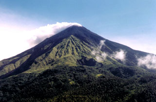
Geological Summary. Karangetang (Api Siau) volcano lies at the northern end of the island of Siau, about 125 km NNE of the NE-most point of Sulawesi. The stratovolcano contains five summit craters along a N-S line. It is one of Indonesia's most active volcanoes, with more than 40 eruptions recorded since 1675 and many additional small eruptions that were not documented (Neumann van Padang, 1951). Twentieth-century eruptions have included frequent explosive activity sometimes accompanied by pyroclastic flows and lahars. Lava dome growth has occurred in the summit craters; collapse of lava flow fronts have produced pyroclastic flows.
Information Contacts: Center of Volcanology and Geological Hazard Mitigation (CVGHM), Jalan Diponegoro 57, Bandung 40122, Indonesia (URL: http://vsi.esdm.go.id/); Hawai'i Institute of Geophysics and Planetology (HIGP) Thermal Alerts System, School of Ocean and Earth Science and Technology (SOEST), Univ. of Hawai'i, 2525 Correa Road, Honolulu, HI 96822, USA (URL: http://modis.higp.hawaii.edu/); Darwin Volcanic Ash Advisory Centre (VAAC), Bureau of Meteorology, Northern Territory Regional Office, PO Box 40050, Casuarina, NT 0811, Australia (URL: http://www.bom.gov.au/info/vaac/); Agence France-Presse (URL: http://www.afp.com/).

