Report on Fukutoku-Oka-no-Ba (Japan) — February 2010
Bulletin of the Global Volcanism Network, vol. 35, no. 2 (February 2010)
Managing Editor: Richard Wunderman.
Fukutoku-Oka-no-Ba (Japan) Airborne ash and cloudy water during 3 February 2010 eruption
Please cite this report as:
Global Volcanism Program, 2010. Report on Fukutoku-Oka-no-Ba (Japan) (Wunderman, R., ed.). Bulletin of the Global Volcanism Network, 35:2. Smithsonian Institution. https://doi.org/10.5479/si.GVP.BGVN201002-284130
Fukutoku-Oka-no-Ba
Japan
24.285°N, 141.481°E; summit elev. -29 m
All times are local (unless otherwise noted)
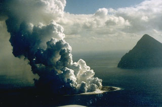
The submarine volcano Fukutoku-Okanoba, frequently the source of discolored water (e.g., BGVN 32:01 and 30:11), erupted on the morning of 3 February 2010, sending a plume of ash and steam 100 m into the air (figure 7) and turning the surrounding ocean a yellow-green color (figure 8). Additional observations of discolored water have been frequently documented in JMA reports since November 2006 (BGVN 32:01).
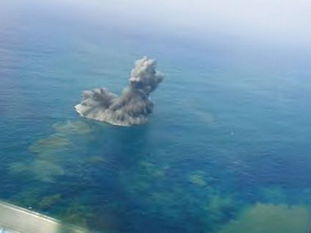 |
Figure 7. Aerial photograph of an ash plume rising from the ocean over Fukutoku-Okanoba on 3 February 2010. Photograph courtesy Japan Coast Guard. |
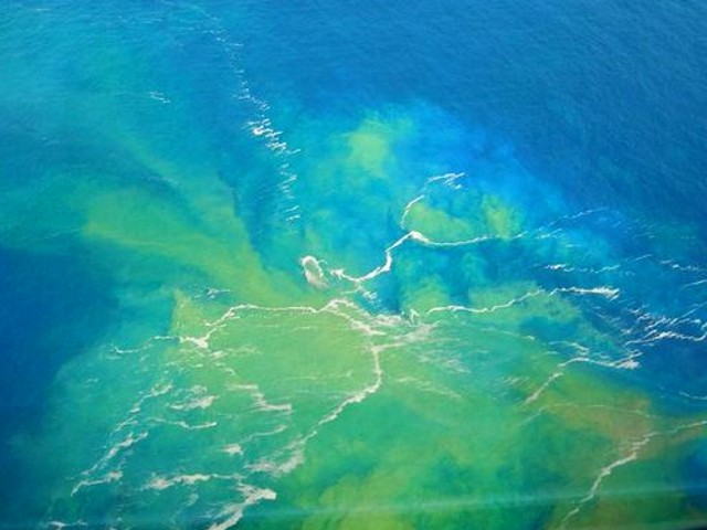 |
Figure 8. During a lull in the 3 February 2010 eruption of Fukutoku-Okanoba, some water above the summit bubbled and took on yellowish-green colors. Aerial photograph courtesy Japan Coast Guard. |
The February 2010 eruption was discovered at about 0745 by the Japan Coast Guard patrol boat Yashima on a routine survey. The crew first noticed "smoke" coming from the surface of the ocean ~ 5 km NNE of the island of Minami-Iwo-jima. The crew also heard a blast and felt its pressure wave. The Yashima continued to monitor the site from a safe distance.
Satellite imagery provided evidence that the activity persisted for at least several days. On 9 February the underwater plume appears as a complex shape N of the volcano (figure 9). Two days later, on 11 February, the plume was spread W of the volcano (figure 10).
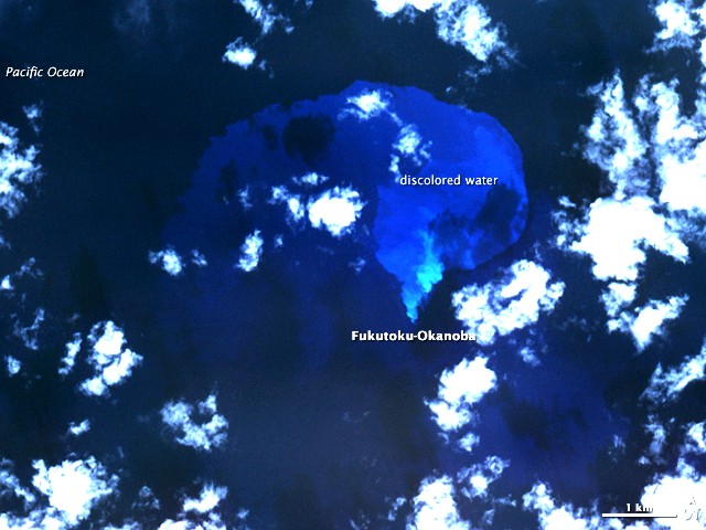 |
Figure 9. On 9 February 2010, the Advanced Spaceborne Thermal Emission and Reflection Radiometer (ASTER) on NASA's Terra satellite captured this false-color image of the ocean around Fukutoku-Okanoba volcano. Water colored by the underwater plume appears lighter in contrast to the surrounding water. The discolored water initially formed a rough V-shape N of the summit. Courtesy of NASA Earth Observatory. |
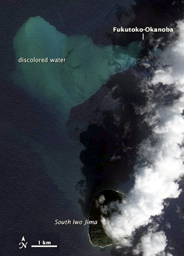 |
Figure 10. Satellite image taken 11 February 2010 of the ocean around Fukutoku-Okanoba volcano. The water colored by the plume forms a V-shape W of the volcano summit. This true-color image (enhanced for publication) was taken by the Advanced Land Imager (ALI) on NASA's EO-1 satellite. Courtesy of NASA Earth Observatory. |
JMA isssued eruption alerts for 9 March and 8 April 2010. This suggests that the eruption continued into April.
Geological Summary. Fukutoku-Oka-no-ba is a submarine volcano located 5 km NE of the island of Minami-Ioto. Water discoloration is frequently observed, and several ephemeral islands have formed in the 20th century. The first of these formed Shin-Ioto ("New Sulfur Island") in 1904, and the most recent island was formed in 1986. The volcano is part of an elongated edifice with two major topographic highs trending NNW-SSE, and is a trachyandesitic volcano geochemically similar to Ioto.
Information Contacts: Japan Meteorological Agency, 1-3-4 Otemachi, Chiyoda-ku, Tokyo 100-8122, Japan (URL: http://www.jma.go.jp/); NASA Earth Observatory (URL: http://earthobservatory.nasa.gov/).