Report on Kuchinoerabujima (Japan) — January 2013

Bulletin of the Global Volcanism Network, vol. 38, no. 1 (January 2013)
Managing Editor: Richard Wunderman.
Kuchinoerabujima (Japan) Increased seismicity, 11 December 2011-5 January 2012
Please cite this report as:
Global Volcanism Program, 2013. Report on Kuchinoerabujima (Japan) (Wunderman, R., ed.). Bulletin of the Global Volcanism Network, 38:1. Smithsonian Institution. https://doi.org/10.5479/si.GVP.BGVN201301-282050
Kuchinoerabujima
Japan
30.443°N, 130.217°E; summit elev. 657 m
All times are local (unless otherwise noted)
Since a small eruption in 1980, Kuchinoerabu-jima experienced numerous periods of elevated seismicity, with volcanic earthquakes and tremor detected at least through December 2009 (BGVN 35:11). The volcano is located in the Ryukyu Island arc, off Japan's SW coast (figure 4).
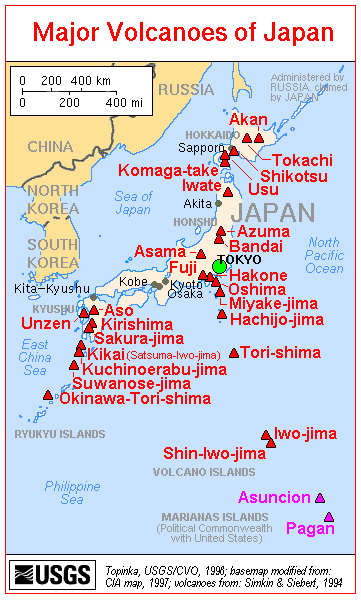 |
Figure 4. A map of the major volcanoes of Japan. Kuchinoerabu-jima is at the lower left. Courtesy of USGS/CVO. |
Recent monthly reports of volcanic activity from the Japan Meteorological Agency (JMA) translated into English resumed in October 2010. The only recent English-translated JMA report on Kuchinoerabu-jima available online through December 2012 was in January 2012. We know of no other recent report on this volcano's seismic activity; therefore, this report summarizes seismicity between December 2011 and January 2012.
According to JMA, seismicity increased to a relatively high level immediately after 11 December 2011, but then decreased on 5 January 2012. On 20 January 2012, the Alert Level was lowered from 2 to 1; JMA noted that the possibility of an eruption was minimal.
During the December 2011-January 2012 period, no significant change in plume activity was observed, and plume heights remained below 100 m above the crater. According to a field survey on 11 January, infrared images (compared to images obtained in December 2011) showed no significant change in temperature distribution either at the summit or on the W slope of Shin-dake (also refered to as Shin-take), the youngest and most active cone.
Field surveys found that sulfur dioxide levels were 50 and 100 metric tons/day on 12 and 13 January 2012, respectively, which were lower than those recorded in December 2011 (200 metric tons/day on 9 December 2011).
According to JMA, continuous GPS measurements have established a baseline across Shin-dake, collecting data since September 2010. Shin-dake's rate of change in surface deformation at the stations has been slowing since September 2011.
Geological Summary. A group of young stratovolcanoes forms the eastern end of the irregularly shaped island of Kuchinoerabujima in the northern Ryukyu Islands, 15 km W of Yakushima. The Furudake, Shindake, and Noikeyama cones were erupted from south to north, respectively, forming a composite cone with multiple craters. All historical eruptions have occurred from Shindake, although a lava flow from the S flank of Furudake that reached the coast has a very fresh morphology. Frequent explosive eruptions have taken place from Shindake since 1840; the largest of these was in December 1933. Several villages on the 4 x 12 km island are located within a few kilometers of the active crater and have suffered damage from eruptions.
Information Contacts: Japan Meteorological Agency (JMA), Otemachi, 1-3-4, Chiyoda-ku Tokyo 100-8122, Japan (URL: http://www.jma.go.jp/).